| Identifier |
2009-042-FA |
| Purpose |
Test new seismic fish and topside unit configuration in a lake setting known to be characterized by methane emissions. |
| Location |
Upper Mystic Lake, Medford, Massachusetts, United States, North America; |
| Summary |
Collected Chirp data over most of lake; Lowrance GPS failed a few times. |
| Comments |
Project = High-Latitude Climate-Hydrates Interactions - Dept. of Energy, High-Latitude Climate-Hydrates Interactions - Dept. of Energy |
| Platform |
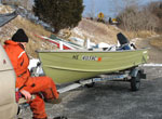
| Terrapin 14-foot Starcraft
|
 |
|
| Itinerary |
| Start |
(port not specified) |
2009-06-08 |
| End |
(port not specified) |
2009-06-08 |
| Days in the field |
1 |
|
| Bounds |
| West |
-71.1556 |
| East |
-71.1412 |
| North |
42.4465 |
| South |
42.4218 |
|