| Identifier | 2010-004-FA | ||||||||
|---|---|---|---|---|---|---|---|---|---|
| Purpose | The purpose of this survey was to collect high-resolution chirp seismic profiles, swath bathymetry, and sidescan sonar backscatter to characterize the surface and subsurface geologic framework offshore of Massachusetts. | ||||||||
| Location | Buzzards Bay, Vineyard Sound, Massachusetts, United States, North America, North Atlantic; | ||||||||
| Summary | USGS Survey 10004 (2010-004-FA) was conducted 13 May-4 June, 2010 aboard the M/V MEGAN MILLER in Buzzards Bay and Vineyard Sound, MA. The purpose of this survey was to collect high-resolution chirp seismic profiles, swath bathymetry, and sidescan sonar backscatter to characterize the surface and subsurface geologic framework offshore of Massachusetts. The survey covered a total of 333 sq. km in northern Buzzards Bay and Vineyard Sound, MA. | ||||||||
| Comments | Leg 1: 13-24 May, 2010; Leg 2: 24 May-4 June, 2010. Project = Massachusetts Coastal Zone Management (MA CZM) Seafloor Mapping - Buzzards Bay and Vineyard Sound, Massachusetts Coastal Zone Management (MA CZM) Seafloor Mapping - Buzzards Bay and Vineyard Sound | ||||||||
| URL | |||||||||
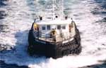
| Platform |
|
||||||||
| Itinerary |
|
||||||||
| Bounds |
|
| Organization |
384 Woods Hole Road
Quissett Campus
Woods Hole, MA02543-1598
(508) 548-8700
|
||||||||||||||||||||
|---|---|---|---|---|---|---|---|---|---|---|---|---|---|---|---|---|---|---|---|---|---|
| Principal investigators | William C Schwab | ||||||||||||||||||||
| Crew members |
|
||||||||||||||||||||
| Information specialist(s) |
|
| Data category: | Environmental Data, Location-Elevation, Seismics, Sonar |
|---|---|
| Data type: | CTD, Navigation, Sub Bottom Profiler, Interferometric, Multibeam, Sidescan, Sound Velocity |
| Equipment | Usage description | Data types | Datasets |
|---|---|---|---|
| Real Time Kinematic GPS | Navigation | (no data reported) | |
| Edgetech chirp subbottom profiler 512i | Sub Bottom Profiler | 2 | |
| Klein 3000 | Sidescan | 1 | |
| SEA SWATHplus-M 234 kHz | Interferometric | (no data reported) | |
| Sensor - MVP30 (Odim) | Sound Velocity | (no data reported) | |
| Temperature and salinity | CTD, Temperature | (no data reported) |
| Dataset name | Equipment | Description | Dataset contact |
|---|---|---|---|
| 2010-004-FA-SE-001 | Edgetech chirp subbottom profiler 512i | Seismic Reflection profiles were collected with Edgetech 512i chirp system. | Linda P McCarthy |
| 2010-004-FA-SE-002 | Edgetech chirp subbottom profiler 512i | Seismic data archived on 37 Blu-ray Discs for entire project. | Linda P McCarthy |
| 2010-004-FA-SO-002 | Klein 3000 | Backscatter data collected during the survey, on (37) Blu-Ray discs, contain all data collected during the survey. | Linda P McCarthy |
| Dataset name | Description | Dataset contact |
|---|---|---|
| BuzzBay_10m | Buzzards Bay: continuous bathymetry and topography terrain model of the Massachusetts coastal zone and continental shelf, (32-bit GeoTIFF, UTM 19 NAD 83, NAVD 88 vertical datum) | Brian Andrews |
| BuzzBay_Source | Buzzards Bay: Polygon boundaries for source data of a continuous bathymetry and topography terrain model of the Massachusetts coastal zone and continental shelf: (Esri polygon shapefile, Geographic, NAD 83) | Brian Andrews |
| Ntkt_VS_10m | Vineyard and Nantucket Sounds, southern coast of Cape Cod including Martha's Vineyard and Nantucket: continuous bathymetry and topography terrain model of the Massachusetts coastal zone and continental shelf, (32-bit GeoTIFF, UTM 19 NAD 83, NAVD 88 vertical datum) | Brian Andrews |
| Ntkt_VS_Source | Vineyard and Nantucket Sounds, Southern coast of Cape Cod including Martha's Vineyard and Nantucket: Polygon boundaries for source data of a continuous bathymetry and topography terrain model of the Massachusetts coastal zone and continental shelf: (Esri polygon shapefile, Geographic, NAD 83) | Brian Andrews |