| Identifier | 2010-015-FA | ||||||||
|---|---|---|---|---|---|---|---|---|---|
| Purpose | Verify multibeam and sidescan sonar datasets in eastern Long Island Sound. | ||||||||
| Location | Long Island Sound, New York, Connecticut, United States, North America, North Atlantic, | ||||||||
| Summary | Bottom sampling and photography were performed to ground-truth NOAA hydrographic surveys H11997, H11999, and H12012. Nine of the stations were occupied in support of a CT DEP Marine Fisheries project. | ||||||||
| Comments | Project = Geology of the State of Connecticut, Geology of the State of Connecticut | ||||||||
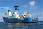
| Platform |
|
||||||||
| Itinerary |
|
||||||||
| Bounds |
|
| Organization |
384 Woods Hole Road
Quissett Campus
Woods Hole, MA02543-1598
(508) 548-8700
|
||||
|---|---|---|---|---|---|
| Principal investigators | Lawrence J Poppe | ||||
| Crew members |
|
||||
| Information specialist(s) |
|
||||
| Affiliate principal | Matt Liebman, EPA; Deb Pacileo, CT DEP | ||||
| Affiliate staff | Marcel Balaval, EPA Jared Balavender, CT DEP Marilyn St. Fleur, EPA Mike Gobell, URI John Gobell, volunteer |
| Data category: | Biological Field Study, Imagery, Location-Elevation, Sampling, Visual Identification, Other |
|---|---|
| Data type: | Experiments (biological), Surveys (biological), Photo, Video, Navigation, Biology, Geology, Species ID |
| Equipment | Usage description | Data types | Datasets |
|---|---|---|---|
| SeaBOSS | Surveys (biological), Experiments (biological), Species ID, Photo, Video, Geology, Biology | (no data reported) | |
| Digital camera | Photo | 1 | |
| GPS (wh) | Navigation | (no data reported) |
| Dataset name | Equipment | Description | Dataset contact |
|---|---|---|---|
| 2010-015-FA-PH-002 | Digital camera | Deck photos of field operations | Lawrence J Poppe |