| Identifier |
2013-013-FA |
| Purpose |
Conduct high-resolution seismic survey around IODP site in Port Valdez, AK to map the sedimentary structure of landslide depoosits Equipment or personnel only. Data, if any, are managed under a different field activity.
|
| Location |
Port Valdez, AK |
| Summary |
PCMSC project. WHSC provided a multichannel streamer for seismic data collection. |
| Info derived |
Sea floor map; |
| Comments |
PCMSC Cruise G-01-13-GA
Pat Hart, Tom Parsons (PI)
Need MCS 24 channel streamer & birds |
| Platform |
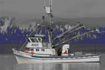
| Alaskan Gyre |
 |
|
| Itinerary |
| Start |
Valdez, AK |
2013-08-26 |
| End |
Valdez,AK |
2013-09-06 |
| Days in the field |
12 |
|
| Bounds |
| West |
-155.75 |
| East |
-132.25 |
| North |
61.75 |
| South |
54.25 |
|