Field Activity 2013-036-FA

Identifier 2013-036-FA
Purpose tectonics and landslide activity in the NE Caribbean.
Location Puerto Rico, the Virgin Islands, and the Dominican Republic, northeast Caribbean, North Atlantic;,
Summary Collected 2,028 kms of multbeam data to fill in data gaps in existing bathymetry coverage of area. Completed 10 ROV dives
Info derived Grain size analysis;Sea floor map;Morphology;
Comments Project = Marine Geohazards/Source Eval,
Platform
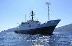
Nautilus
Length 211 feet; beam 34.5 feet; draft 14.75 feet.
Itinerary
Start San Juan, PR 2013-10-02
End San Juan, PR 2013-10-18
Days in the field 14
Bounds
West -70
East -63
North 20
South 17

Personnel

Organization
384 Woods Hole Road
Quissett Campus
Woods Hole, MA02543-1598
(508) 548-8700
Principal investigators Uri Ten Brink
Crew members
William W Danforth
Scientist, Staff
Brian Andrews
Scientist, Staff
Information specialist(s)
Jason Chaytor
Specialist, Information
Brian Andrews
Specialist, Information
Affiliate principal Jason Chaytor, USGS-WHSC, Dwight Coleman, URI, Amanda Demopoulos, USGS-SESC
Affiliate staff Ocean Exploration Trust ship and shore personnel Two scientists from the University of Puerto Rico

Data types and categories

Data category: Sampling, Sonar
Data type: Geology, Multibeam, Single Beam

Equipment used

Equipment Usage description Data types Datasets
EM 302 Multibeam (no data reported)
Grab sampler Biology, Geology (no data reported)
Echosounder Single Beam (no data reported)

Publications

Samples collected during this field activity