| Identifier | 2014-317-FA | ||||||||
|---|---|---|---|---|---|---|---|---|---|
| Alternate names | 14BIM05 | ||||||||
| Purpose | Characterize the geologic framework | ||||||||
| Location | Breton Island, Chandeleur Islands, Louisiana, Gulf of America (Gulf of Mexico) | ||||||||
| Summary | Collected side scan sonar, sub-bottom profile (93 lines), magnetometer, and swath bathymetry (76 lines) data. | ||||||||
| Info derived | Bathymetry, nearsurface geology, and island elevation. | ||||||||
| Comments | Entries for this field activity are based on entries from Field Activity 2014-314-FA | ||||||||
| Projects | |||||||||
| Platform |
|
||||||||
| Vehicles | Excursion - White
Ford F-350 Dually White (GSA)
Ford F-350 Dually Silver (GSA)
White Dodge Pickup - White
|
||||||||
| Itinerary |
|
||||||||
| Bounds |
|
||||||||
| Marine operations | Yes |
| Organization |
600 Fourth Street South
St. Petersburg, FL33701-4846
(727) 502-8000
|
||||||||||
|---|---|---|---|---|---|---|---|---|---|---|---|
| Organization | Other(Other) |
||||||||||
| Principal investigators | James G FlocksJennifer L Miselis | ||||||||||
| Crew members |
|
||||||||||
| Information specialist(s) |
|
| Data category: | Electro-Magnetic, Location-Elevation, Seismics, Sonar |
|---|---|
| Data type: | Magnetics, Navigation, Sub Bottom Profiler, Interferometric, Sidescan, Sound Velocity |
| Equipment | Usage description | Data types | Datasets |
|---|---|---|---|
| Geometrics G-882 (Cesium) Marine Magnetometer | Magnetics | (no data reported) | |
| F190 DGPS/IMU | Navigation | 1 | |
| Chirp 512i | Sub Bottom Profiler | 1 | |
| Klein Side Scan Sonar | Sidescan | 3 | |
| Interferometric Bathymetry System | Interferometric | 1 | |
| Valeport SVP | Sound Velocity | (no data reported) | |
| Ashtech Z-Xtreme DGPS | Benchmarks, Navigation | (no data reported) | |
| Other | Unknown, Multichannel, Boomer, Sub Bottom Profiler, Sparker, Bubble Gun, Air Gun / Water Gun, Ocean Bottom Seismometer, Sonobuoy | (no data expected) |
| Dataset name | Equipment | Description | Dataset contact |
|---|---|---|---|
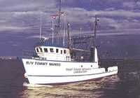
| 14BIM05_IFB_tracklines.zip | F190 DGPS/IMU | Swath tracklines – R/V Tommy Munro | Nancy T DeWitt |
| DS 972 SEGY | Chirp 512i | Raw chirp SEGY data | Arnell S Forde |
| 14BIM05_SSS_50cm_WGS84_UTM16N_Tile | Klein Side Scan Sonar | Sidescan Sonar Mosaic 0.50-m resolution | Nancy T DeWitt |
| 14BIM05_IFB_xyz.zip | Interferometric Bathymetry System | Swath data 5-m BASE resolution – R/V Tommy Munro | Nancy T DeWitt |
| Dataset name | Equipment | Description | Dataset contact |
|---|---|---|---|
| Breton2014-GIS.zip | Klein Side Scan Sonar | Esri ArcGIS project | Nancy T DeWitt |
| Breton_2014-DEM.zip | Klein Side Scan Sonar | Bathymetry DEM 100-m cell size | Nancy T DeWitt |