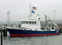
Identifier | 2015-072-FA | ||||||||
---|---|---|---|---|---|---|---|---|---|
Purpose | Instrumentation test follow on to 2014 MVCO experiment | ||||||||
Location | MVCO | ||||||||
Summary | Deploy quadpod and NIMBBLE sled | ||||||||
Info derived | oceanographic time series | ||||||||
Comments | Associated with 2015-076-FA. Data is available at http://dx.doi.org/10.5066/F7736P28 | ||||||||
Projects | |||||||||
Platform |
|
||||||||
Itinerary |
|
||||||||
Bounds |
|
||||||||
Scuba operations | Yes |
Organization |
384 Woods Hole Road
Quissett Campus
Woods Hole, MA02543-1598
(508) 548-8700
|
||||||||
---|---|---|---|---|---|---|---|---|---|
Principal investigators | Christopher R Sherwood | ||||||||
Crew members |
|
||||||||
Information specialist(s) |
|
||||||||
Affiliate principal | Malcolm Scully, WHOI |
Data category: | Location-Elevation, Time Series |
---|---|
Data type: | Navigation, Mooring (physical oceanography) |
Equipment | Usage description | Data types | Datasets |
---|---|---|---|
Bottom platform | Mooring (physical oceanography) | 1 | |
Other | Unknown, Profiles, Transects, Benchmarks, LIDAR, Navigation | (no data reported) |
Dataset name | Equipment | Description | Dataset contact |
---|---|---|---|
MVCO_15 timeseries data | Bottom platform | data from all sensors on both platforms | Ellyn Montgomery |