Field Activity 2023-012-FA

Identifier 2023-012-FA
Alternate names Marconi Beach 2023
Purpose To characterize the beach and nearshore morphology to validate the USGS Total Water Level and Coastal Change Forecast that uses the ARGUS Camera systems (CoastCams) to visualize and map the beach and nearshore region to determine the types of bar morphologies, their persistence and temporal variability, and the relationship of these changes to wave and water-level conditions. Includes subaerial survey measurements to map the beach; aerial imagery from kite/balloon to map the beach; and bathymetric soundings from WHOI autonomous surface vehicle to map nearshore. May include measurments to calibrate the CoastCam.
Location Marconi Beach, Wellfleet, Cape Cod National Seashore, Barnstable County, MA, United States
Summary 
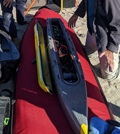
Bathymetry data was collected with the ASV Yellowfin on March 20 by J. Over and P. Traykovski, P. Berube assisted. Helikite was flown on March 22 by J. Over, C. Sherwood, and assisted by M. Carson. Wind was onshore and thus the water line was not mapped.
Info derived Yearly update on topography and bathymetry of the beach and nearshore region in view of the cameras.
Comments There will be two days of surveying based on weather. Entries for this field activity are based on entries from Field Activity 2022-014-FA.
Projects
Platform
WHOI Yellowfin
remote controlled autonomous self-righting surf vehicle equipped with Cerulean Sonar S-500 Sounder and WHOI built logger.
on foot
survey conducted on foot
Itinerary
Start Falmouth, MA 2023-03-20
End Falmouth, MA 2023-03-22
Days in the field 2
Bounds
West -69.96565313
East -69.95105473
North 41.89900178
South 41.8898755

Personnel

Organization
384 Woods Hole Road
Quissett Campus
Woods Hole, MA02543-1598
(508) 548-8700
Principal investigators Christopher R Sherwood
Crew members
Christopher R Sherwood
Scientist, Staff
Over, Jin-Si
Scientist, Staff
Information specialist(s)
Over, Jin-Si
Specialist, Information
Affiliate principal Peter Traykovski (WHOI)

Data types and categories

Data category: Sonar, Location-Elevation, Imagery
Data type: Single Beam, Navigation, Photo

Equipment used

Equipment Usage description Data types Datasets
Sony a6000 JPEG taken every 5 seconds for use in structure from motion Photo 3
UAS- heli-kite Filled with helium and towed by hand up and down the beach with a digital camera and ppk GPS attached. Photo, Navigation, Video (no data reported)
PPK GPS Hot shoed to the camera so there is highly accurate photo location information Navigation (no data reported)
Cerulean Sonar S-500 Sounder placed in ASV to record depth to seafloor Single Beam 1
Spectra Precision SP80 used as a base and rover in RTK mode to provide location information for QA/QC Navigation (no data reported)
Aeropoint targets Placed in survey area as ground control for structure from motion Navigation, Transects, Profiles 1

Datasets

Datasets produced in this activity

Dataset name Equipment Description Dataset contact
2023012FA_Marconi_DSM Sony a6000 Digital Surface Model representing Marconi Beach, Wellfleet, MA on March 22, 2023 Jin-Si R Over
2023012FA_Marconi_imagery Sony a6000 Low-altitude aerial imagery collected from a Helikite at Marconi Beach, Wellfleet, MA on March 22, 2023. Also includes the images locations in a CSV file. Jin-Si R Over
2023012FA_Marconi_ortho Sony a6000 Orthomosaic representing Marconi Beach, Wellfleet, MA on March 22, 2023. Jin-Si R Over
2023012FA_Marconi_bathymetry Cerulean Sonar S-500 Sounder Bathymetric data and grid of offshore Marconi Beach, Wellfleet, MA on March 20, 2023 Jin-Si R Over
2023012FA_Marconi_navigation Aeropoint targets Ground control points Marconi Beach, Wellfleet, MA on March 22, 2023 Jin-Si R Over

Publications

Samples collected during this field activity