| Identifier |
2025-663-FA |
| Alternate names |
CenCA_coastal_20251228 |
| Purpose |
collect aerial photography |
| Location |
Central California coast between Bolinas Head and Monterey |
| Summary |
collected 3248 oblique coastal aerial survey images from Bolinas Head to Monterey. Note: Camera time in PST (UTC - 8) |
| Info derived |
photos, navigation |
| Comments |
Entries for this field activity are based on entries from Field Activity 2024-669-FA. |
| Projects |
|
| Platform |
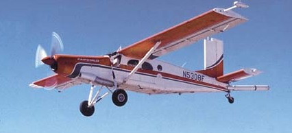
| Airplane |
 |
|
| Vehicles |
|
| Itinerary |
| Start |
Bolinas Head, CA |
2025-12-28 |
| End |
Monterey, CA |
2025-12-28 |
| Days in the field |
1 |
|
| Bounds |
| West |
-122.698887 |
| East |
-121.795827 |
| North |
37.899433 |
| South |
36.606377 |
|
