| Identifier | A286BS | ||||||||
|---|---|---|---|---|---|---|---|---|---|
| Alternate names | A-2-86-BS | ||||||||
| Purpose | Study disturbances to substrate and erosion by gray whale, walrus, and ice gouge. | ||||||||
| Description | University of Alaska,United States Geological Survey, Menlo Park, California. Chief Scientist: Unspecified. Geological and Geophysical data (CTDmeter, sidescansonar, LoranC) of field activity A-2-86-BS in St. Lawrence Island, St. Matthew Island from 06/06/1986 to 06/23/1986 | ||||||||
| Location | St. Matthew Island | ||||||||
| Comments | A flume was used. Staff information imported from InfoBank Kaj Henrikson - Unspecified L. Cooper - Unspecified M. Silberstein - Unspecified A. Daubin - Unspecified John Barber (USGS Western Region) - Unspecified D. Arnold - Unspecified L. Lowry - Unspecified K. Schaffer - Unspecified B. Stewart - Unspecified B. Tershy - Unspecified J. Schoenherr - Unspecified J. Heine (Unspecified) S. Dubenhoffer - Unspecified | ||||||||
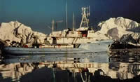
| Platform |
|
||||||||
| Itinerary |
|
||||||||
| Bounds |
|
||||||||
| Activity | Geological and Geophysical |
| Organization |
University of Alaska
Seward, AK
|
||||||||
|---|---|---|---|---|---|---|---|---|---|
| Organization |
2885 Mission Street
Santa Cruz, CA95060
(831) 460-7401
|
||||||||
| Crew members |
|
||||||||
| Affiliate staff | Kaj Henrikson - Unspecified,M. Silberstein - Unspecified,D. Arnold - Unspecified,L. Lowry - Unspecified,K. Schaffer - Unspecified,B. Stewart - Unspecified,B. Tershy - Unspecified,J. Schoenherr - Unspecified,J. Heine (Unspecified) |
| Data category: | Environmental Data, Sonar, Location-Elevation |
|---|---|
| Data type: | CTD, Sidescan, Navigation |
| Equipment | Usage description | Data types | Datasets |
|---|---|---|---|
| CTD | Surveys (geochemical), Experiments (geochemical), CTD | (no data reported) | |
| sidescansonar | Sidescan | (no data reported) | |
| LoranC | Navigation | (no data reported) |