| Identifier | B172BS | ||||||||
|---|---|---|---|---|---|---|---|---|---|
| Alternate names | B-1-72-BS | ||||||||
| Description | United States Geological Survey, Menlo Park, California. Geophysical data (bathymetry, magnetics) of field activity B-1-72-BS in Bering Sea, Alaska from 08/27/1972 to 09/17/1972 | ||||||||
| Location | Alaska | ||||||||
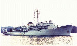
| Platform |
|
||||||||
| Itinerary |
|
||||||||
| Bounds |
|
||||||||
| Activity | Geophysical |
| Organization |
2885 Mission Street
Santa Cruz, CA95060
(831) 460-7401
|
||
|---|---|---|---|
| Crew members | |||
| Information specialist(s) |
|
| Data category: | Electro-Magnetic, Location-Elevation, Sonar |
|---|---|
| Data type: | Magnetics, Navigation, Single Beam |
| Equipment | Usage description | Data types | Datasets |
|---|---|---|---|
| bathymetry | Single Beam | 1 | |
| magnetics | Magnetics | 2 | |
| integratednavigation | Navigation | 1 |
| Dataset name | Equipment | Description | Dataset contact |
|---|---|---|---|
| Raw depth (bathymetry) data | bathymetry | Provisional best file | Alan K Cooper |
| Edited magnetics data | magnetics | Provisional best file | Alan K Cooper |
| sparker - magnetics profile plots | magnetics | Analog Materials list | Carol A Reiss |
| Integrated navigation (SINS) data | integratednavigation | Provisional best file | Alan K Cooper |