| Identifier | C0213PS | ||||||||
|---|---|---|---|---|---|---|---|---|---|
| Alternate names | C-02-13-PS | ||||||||
| Purpose | Characterize the variability and processes affecting surface water and water column habitat conditions across the Salish Sea and identify patterns associated with land use and climate change. | ||||||||
| Description | United States Geological Survey, Pacific Science Center,United States Geological Survey, Western Fisheries Research Center,Swinomish Indian Tribal Community, Water Resources Program,Squaxin Island Tribe,Nisqually Tribe,Samish Indian Nation. Chief Scientist: Eric Grossman. Sampling data of field activity C-02-13-PS in Salish Sea (Puget Sound, Strait of Juan de Fuca, Georgia Strait) from 07/15/2013 to 08/01/2013 | ||||||||
| Location | Georgia Strait) | ||||||||
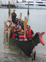
| Info derived | surface water properties/quality data along several routes of the Salish Sea Tribal Journey | ||||||||
| Comments | Staff information imported from InfoBank Sarah Grossman Swinomish Indian Tribal Community Squaxin Island Tribe Nisqually Tribe Samish Indian Nation | ||||||||
| Projects | |||||||||
| Platform |
|
||||||||
| Itinerary |
|
||||||||
| Bounds |
|
||||||||
| Activity | Sampling |
| Organization |
2885 Mission Street
Santa Cruz, CA95060
(831) 460-7401
|
||
|---|---|---|---|
| Organization | USGS, Western Fisheries Research Center |
||
| Organization | Swinomish Tribe |
||
| Organization | Squaxin Island Tribe |
||
| Organization | Nisqually Tribe |
||
| Organization | Samish Indian Nation |
||
| Principal investigators | Eric Grossman | ||
| Crew members | |||
| Information specialist(s) |
|
||
| Affiliate staff | Sarah Grossman,Swinomish Indian Tribal Community,Squaxin Island Tribe,Nisqually Tribe,Samish Indian Nation |
| Data category: |
|---|