Feasibility study to determine if high resolution seismic reflection data of reasonable quality could be collected in the Columbia River to help assess earthquake hazards of the Portland, OR / Vancouver, WA metropolitan area.
Description
United States Geological Survey, Menlo Park, California. Chief Scientists: Holly Ryan, Andy Stevenson. Geophysical data (Geopulse, mudshark, YoNav) of field activity C-1-94-WO in Columbia River from 07/18/1994 to 07/25/1994
Location
Columbia River
Summary
Approximately 3 1/2 days of geopulse data were collected in six areas of the Columbia River between Astoria, OR and Washougal, WA across the following fault zones: Clatskanie, Columbia River, Chinook, Firn Hill, Portland Hills,and Frontal fault zones, and unnamed faults near Portland International Airport, and Trojan nuclear power plant. Navigation and seismic data were merged and recorded on two optical disks. 14 rolls (representing different geographic locations) of analog data were collected.
Info derived
Seismic reflection profiles from Geopulse and trackline map.
Comments
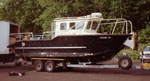
Navigation data are in USGS data base. The rest of the data should be input by 1/1/95, unless requested sooner. (modified from 7/29/94 USGS Bulletin) COLUMBIA RIVER CRUISE Holly Ryan, Andy Stevenson, and Jim Vaughn are back from a successful but HOT--+100d F!) 5-day reconnaissance cruise to the Columbia River collecting high resolution geopulse data in search of recent upper crustal faulting, as part of the Cascadia earthquake hazards project. Al Niem from Oregon State University joined us for two days. Data were collected aboard the Cathlamet Bay, a 26-foot Army Corps of Engineering boat that allowed data acquisition in only a few meters of water. The logistics of mounting all of the equipment on the boat was somewhat of a headache, but the expertise of the boat driver, Terry Vance of the Corps, more than made up for the lack of space, and contributed immensely to the success of the cruise. Although we were not able to image much more than about 10 to 20 m below the river bottom, we did observe evidence suggestive of recent faulting at several sites. These included the northern and southern bounding faults of Portland Basin, near Portland International Airport, near the now defunct Trojan nuclear power plant, and along northwest trending faults in the lower Columbia River near Astoria. We hope to be able to go back at some time in the future using a larger source to be able to confirm our results.
Staff information imported from InfoBank
Holly Ryan (USGS Western Region) - Chief Scientist
Andy Stevenson (USGS Western Region) - Chief Scientist