| Identifier | C2069BS | ||||||||
|---|---|---|---|---|---|---|---|---|---|
| Alternate names | C-20-69-BS | ||||||||
| Purpose | Geophysical | ||||||||
| Description | Lamont-Doherty Earth Observatory. Geophysical data (navigation) of field activity C-20-69-BS in Bering Sea, AK from 01/01/1969 to 01/01/1969 | ||||||||
| Location | AK | ||||||||
| Info derived | Geophysical data | ||||||||
| Comments | Leg 20. Information derived from track chart. | ||||||||
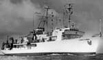
| Platform |
|
||||||||
| Itinerary |
|
||||||||
| Bounds |
|
||||||||
| Activity | Geophysical |
| Organization |
Lamont Doherty Earth Observatory(LDEO)
Pallisades, NY
|
|---|
| Data category: | Location-Elevation |
|---|---|
| Data type: | Navigation |
| Equipment | Usage description | Data types | Datasets |
|---|---|---|---|
| navigation | Navigation | (no data reported) |