| Identifier |
H305AR |
| Alternate names |
H-3-05-AR,HLY0503 |
| Purpose |
Deciphering the Tectonic History, Structure and Stratigraphy of the Arctic
Basin and Plate Boundries |
| Location |
Arctic Ocean |
| Summary |
47 lines of seismic reflection data,
97 sonobuoy seismic refraction data
gravity anomaly data, swath bathymetry, sub-bottom profiles |
| Info derived |
Deciphering the Tectonic History, Structure and Stratigraphy of the Arctic
Basin and Plate Boundries |
| Comments |
Equipment details:
16 to 24 channel streamer, 200 to 300 meters length;
Airgun seismic reflection and sonobuoy refraction;
Multibeam swath bathymetry (Seabeam model 2112);
Gravimeter (Bell BGM-3);
Chirp sub-bottom profiler.
Co-Chief Scientists:
Bernard Coakley, Univ. of Alaska, Fairbanks AK;
Yngve Kristoffersen, Univ. of Bergen, Bergen, Norway:
John Hopper, Texas A&M, College Station TX. |
| Projects |
|
| Platform |
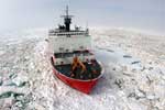
| Healy Length 420 feet; beam 82 feet; draft 29 feet.
|
 |
|
| Itinerary |
| Start |
Dutch Harbor, Alaska |
2005-08-05 |
| End |
Tromso, Norway |
2005-09-30 |
|
| Bounds |
| West |
-70.1367 |
| East |
-12.40234375 |
| North |
84.35754105 |
| South |
55.54722014 |
|