Field Activity IR209MB

Identifier IR209MB
Alternate names I-R2-09-MB
Purpose Collect oceanographic data to understand influence of dredge disposal on nearshore ecosystems
Description 
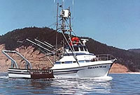
United States Geological Survey, Pacific Science Center. Chief Scientist: Curt Storlazzi. Oceanographic instrument deployment data of field activity I-R2-09-MB in Monterey Bay from 12/15/2009 to 12/15/2009
Location Monterey Bay
Info derived current speed, current direction, acoustic backscatter, wave height, wave period, wave direction, tidal height, optical backscatter, sediment grain size, temperature, salinity
Comments Recovery of SCH_20m_Tripod and SCH_30m_Tripod. Deployment on I-D2-09-MB; 10/21/2009
Projects
Platform
Shana Rae
Length: 52 feet; Beam: 16.5 feet.
Itinerary
Start Santa Cruz Harbor 2009-12-15
End Santa Cruz Harbor 2009-12-15
Bounds
West -122.5
East -121.75
North 37
South 36.75
Activity oceanographic instrument deployment

Personnel

Organization
2885 Mission Street
Santa Cruz, CA95060
(831) 460-7401
Principal investigators Curt Storlazzi
Crew members
Information specialist(s)
Joshua Logan
Specialist, Information

Data types and categories

Data category: Location-Elevation, Time Series
Data type: Navigation, Mooring (physical oceanography)

Equipment used

Equipment Usage description Data types Datasets
GPS Navigation 2
instrumentmooring Geology, Mooring (physical oceanography) 1
tripod Mooring (physical oceanography) 1

Datasets

Datasets produced in this activity

Dataset name Equipment Description Dataset contact
Best file with nav in ArcInfo E00 format GPS Joshua Logan
Global positioning system (GPS) data i-r2-09-mb.060 GPS Provisional best file Joshua Logan
Station Information instrumentmooring Joshua Logan
Station Information tripod Joshua Logan

Publications

Samples collected during this field activity