Conducted an intensive shoreline survey around the Prince William Sound area to gather data on the nature of shoreline devastation following the 27 March 1964 Earthquake.
Description
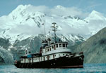
Chief Scientists: George Plafker, James Case, L.R. Mayo. Geological data (navigation) of field activity M-1-64-EG in Prince William Sound, Eastern Gulf of Alaska from 05/20/1964 to 06/10/1964
Location
Eastern Gulf of Alaska
Info derived
Land failure, slumps, slides, rock falls, heights of wave trim lines, direction of waves and inferred intensity of waves.
Comments
Staff information imported from InfoBank
George Plafker (USGS Western Region) - Chief Scientist
James Case - Chief Scientist
L.R. Mayo - Chief Scientist