Field Activity N0111GA

Identifier N0111GA
Alternate names N-01-11-GA
Purpose deploy and recover ocean-bottom seismometers
Description United States Geological Survey,University Texas Institute of Geophysics,Woods Hole Oceanographic Institution. Chief Scientists: Ginger Barth, USGS, Sean Gulick, University Texas Institute of Geophysics (UTIG). Geophysical surveying data of field activity N-01-11-GA in Central Gulf of Alaska, North Pacific from 06/16/2011 to 06/23/2011
Location North Pacific
Info derived long-offset seismic refraction
Comments Ginger Barth, USGS, and Sean Gulick, UTIG, PI; ocean-bottom seismometers (OBS) recorded seismic shots generated by R/V Langseth, MGL1109 / L-09-11-GA Staff information imported from InfoBank Ginger Barth - USGS Sean Gulick (UTIG, ) - University Texas Institute of Geophysics Non USGS data manager = Sean Gulick
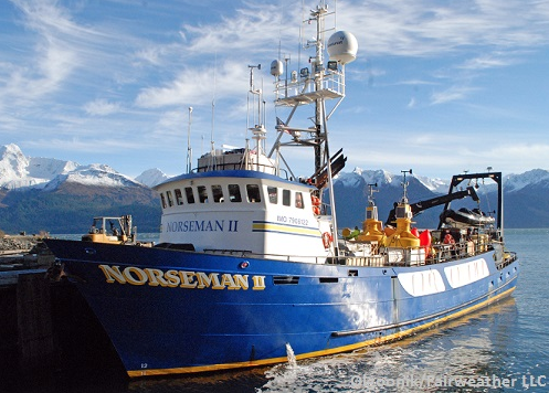
Platform
Norseman_II
L.O.A. 115 ft. Beam 28 ft. Draft 13 ft. Decks 3 Gross Tonnage 196 Propulsion 850 hp Cat Diesel Speed 10 Knots Endurance 90+ Days Range 10,000 miles
Itinerary
Start Kodiak, AK 2011-06-16
End Kodiak, AK 2011-06-23
Bounds
West -155.75
East -132.25
North 61.75
South 54.25
Activity geophysical surveying

Personnel

Organization
2885 Mission Street
Santa Cruz, CA95060
(831) 460-7401
Principal investigators Ginger Barth
Crew members
Ginger Barth
Scientist, Staff
Information specialist(s)
Ginger Barth
Specialist, Information
Affiliate principal Sean Gulick (UTIG, )
Affiliate staff Sean Gulick (UTIG, ) - University Texas Institute of Geophysics

Data types and categories

Data category: Location-Elevation, Seismics
Data type: Navigation, Ocean Bottom Seismometer

Equipment used

Equipment Usage description Data types Datasets
GPS Navigation (no data reported)
bottomseismometer Ocean Bottom Seismometer (no data reported)

Publications

Samples collected during this field activity