Field Activity S504SC

Identifier S504SC
Alternate names S-5-04-SC
Purpose Seafloor mapping and habitat characterization.
Description United States Geological Survey, Menlo Park, California,National Oceanic and Atmospheric Administration,Channel Islands National Marine Sanctuary. Chief Scientist: Guy Cochrane. Geological and Geophysical data (Kleinsidescan, underwatertelevision, YoNav) of field activity S-5-04-SC in Northern Channel Islands, Southern California from 08/15/2004 to 08/27/2004
Location Southern California
Summary Video: 5935 m S. Anacapa 13268m, Anacapa Passage, 3776 S. Santa Cruz. Sidescan: 62 sq km N. San Miguel.
Info derived Sidescan sonar backscatter surficial bottom imagery, and video groundtruthing imagery.
Comments 
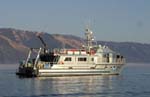
Associated cruises in southern California: B-1-98-SC B-1-99-SC B-2-99-SC M-1-99-SC M-1-00-SC J-1-02-SC M-1-02-SC M-1-03-SC S-5-04-SC First USGS use of the NOAA R/V Shearwater. Staff information imported from InfoBank Guy Cochrane (USGS Menlo Park) - Chief Scientist Jamie Conrad (USGS, CMG) - Geologist Mike Boyle (USGS, CMG) - ET Sarah Fangman (NOAA, CINMS) - Biologist Margie Boyle (Volunteer) - Camera technician Lew Moody (NOAA) - Pilot Terrance Shinn (NOAA) - Pilot
Projects
Platform
Shearwater
62-foot high-speed Teknicraft catamaran; beam 24 feet; Draft 3 feet.
Itinerary
Start Santa Barbara, CA 2004-08-15
End Santa Barbara, CA 2004-08-27
Bounds
West -120.5036
East -119.26316
North 34.40881
South 33.93144
Activity Geological and Geophysical

Personnel

Organization
2885 Mission Street
Santa Cruz, CA95060
(831) 460-7401
Organization
National Oceanic and Atmospheric Administration(NOAA)
Organization
Channel Islands Research Reserve
Principal investigators Guy R Cochrane
Crew members
James E Conrad
Scientist, Staff
Michael E Boyle
Scientist, Staff
Boyle, Margie
Scientist, Staff
Information specialist(s)
Guy R Cochrane
Specialist, Information
Affiliate staff Sarah Fangman (NOAA, CINMS) - Biologist,Lew Moody (NOAA) - Pilot,Terrance Shinn (NOAA) - Pilot

Data types and categories

Data category: Sonar, Imagery, Location-Elevation
Data type: Sidescan, Video, Navigation

Equipment used

Equipment Usage description Data types Datasets
Kleinsidescan Sidescan 2
underwatertelevision Video 1
YoNav Navigation 3

Datasets

Datasets produced in this activity

Dataset name Equipment Description Dataset contact
File list Kleinsidescan Guy R Cochrane
Survey information Kleinsidescan Guy R Cochrane
Survey information underwatertelevision Guy R Cochrane
Best file with nav in ArcInfo E00 format YoNav Guy R Cochrane
Global positioning system (GPS) data s-5-04-sc.060 YoNav Provisional best file Guy R Cochrane
Global positioning system (GPS) data s-5-04-sc.060_ll YoNav Guy R Cochrane

Publications

Samples collected during this field activity