Characterize the surface and groundwater hydrology in the coastal Everglades
Location
Everglades National Park, FL
Summary
This task of the project collects continuous hydrological data from a network of 16 sites along several drainages in the coastal Everglades. Sites vary from freshwater wetlands (in headwater areas) to mangrove forests in downstream, tidal regions.
Info derived
Surface-water stage, temperature and conductivity; Ground-water level, temperature and conductivity; Depth and duration of wetland flooding
Comments
Additional Equipment: YSI 600R temperature and conductivity sensor, Float and Pulley water level recorders, metri-tape water level recorders.
Platform
25-ft Parker
19-ft SeaCraft
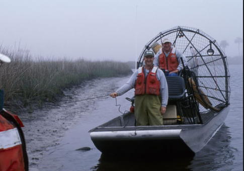
Airboat
Per OPS Manager, platform was transferred to the Gainesville office around 2016.
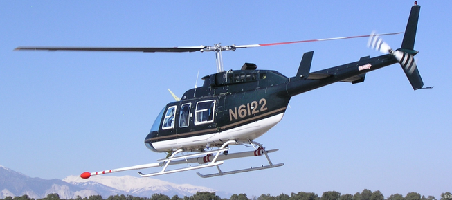
Helicopter (SP)
Itinerary
Start
Various, all within Everglades NP
2007-01-01
End
Various, all within Everglades NP
2007-12-31
Bounds
West
-81.408
East
-80.54140859
North
25.54061741
South
24.95331646
Topic
50
Personnel
Organization
U.S. National Park Service
Organization
U.S. Army Corps of Engineers, Jacksonville District(USACE)