| Identifier | 10CCT01 | ||||||||
|---|---|---|---|---|---|---|---|---|---|
| Purpose | An additional survey area off of Cat Island that will be incorporated into the complete modern topobathymetric map of the Mississippi barrier islands from Cat Island to Dauphin Island. Data to provide information for the following: assessment of immediate sand resources in the region, modern geologic framework; historical island change measurements | ||||||||
| Location | Cat Island, MS to Dauphin Island, AL | ||||||||
| Info derived | Submetrix swath bathymetry data (X, Y, Z); shallow sub-bottom image profiles, side-scan sonar mosaics | ||||||||
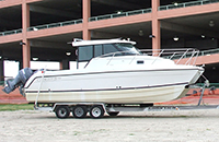
| Platform |
|
||||||||
| Itinerary |
|
||||||||
| Bounds |
|
||||||||
| Marine operations | Yes |
| Organization |
600 Fourth Street South
St. Petersburg, FL33701-4846
(727) 502-8000
|
||||||
|---|---|---|---|---|---|---|---|
| Principal investigators | James G Flocks | ||||||
| Crew members |
|
||||||
| Information specialist(s) |
|
| Data category: | Location-Elevation, Seismics, Sonar |
|---|---|
| Data type: | Benchmarks, Navigation, Profiles, Transects, Sub Bottom Profiler, Multibeam, Sidescan |
| Equipment | Usage description | Data types | Datasets |
|---|---|---|---|
| Sidescan Sonar | Sidescan | 1 | |
| Chirp 424 | Sub Bottom Profiler | 5 | |
| Interferometric Bathymetry System | Interferometric | 3 | |
| F190 DGPS/IMU | Navigation | 5 |
| Dataset name | Equipment | Description | Dataset contact |
|---|---|---|---|
| 10cct01_v2_ss_1m_b | Sidescan Sonar | Sidescan sonar mosaic as GeoTiff | Nancy T DeWitt |
| 10CCT01-SE-pd-1 | Chirp 424 | Chirp 424 data navigation | Arnell S Forde |
| 10CCT01-SE-pd-2 | Chirp 424 | Chirp 424 data profiles | Arnell S Forde |
| 10CCT01-SE-pd-3 | Chirp 424 | Chirp 424 data GIS | Arnell S Forde |
| 10CCT01-SE-pd-4 | Chirp 424 | Chirp 424 data GeoMapApp | Arnell S Forde |
| 10CCT01-SE-pd-5 | Chirp 424 | Chirp 424 data agc SEGY | Arnell S Forde |
| 10cct01_v2rbf_50m | Interferometric Bathymetry System | Interferometric swath bathy grid as GeoTiff, 50-m resolution | Nancy T DeWitt |
| 10cct01_xyzi | Interferometric Bathymetry System | Interferometric swath bathy grid in ascii format, 50-m resolution | Nancy T DeWitt |
| Data series 563 arc | Interferometric Bathymetry System | Data Series 563 GIS dataset | Nancy T DeWitt |
| 10CCT01-NL-pd-1 | F190 DGPS/IMU | HYPACK navigation tracklines as a shapefile | Nancy T DeWitt |
| 10cct01_ss_tracklines | F190 DGPS/IMU | Sidescan sonar navigation tracklines as Geotiff | Nancy T DeWitt |
| 10cct01_sw_tracklines | F190 DGPS/IMU | Swath navigation tracklines as Geotiff | Nancy T DeWitt |
| Processed 1,000-Shot-Interval Location Navigation | F190 DGPS/IMU | Arnell S Forde | |
| Processed Shotpoint Navigation | F190 DGPS/IMU | Arnell S Forde |