| Identifier | 10CEV05 | ||||||||
|---|---|---|---|---|---|---|---|---|---|
| Purpose | Coring Garrison and Fisk Basins (Gulf of Mexico) for paleoceanographic reconstruction | ||||||||
| Location | Garrison and Fisk basins, Northern Gulf of Mexico | ||||||||
| Info derived | Box cores | ||||||||
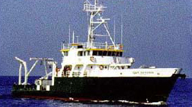
| Platform |
|
||||||||
| Itinerary |
|
||||||||
| Bounds |
|
| Organization |
600 Fourth Street South
St. Petersburg, FL33701-4846
(727) 502-8000
|
||||||||||
|---|---|---|---|---|---|---|---|---|---|---|---|
| Organization | Other(Other) |
||||||||||
| Principal investigators | Richard Z Poore | ||||||||||
| Crew members |
|
||||||||||
| Information specialist(s) |
|
| Data category: | Sampling |
|---|---|
| Data type: | Geology |
| Equipment | Usage description | Data types | Datasets |
|---|---|---|---|
| Box Corer | Biology, Geology | 2 |
| Dataset name | Equipment | Description | Dataset contact |
|---|---|---|---|
| Foram_geochemistry.zip | Box Corer | This file contains the downcore Mg/Ca, δ18O and δ13C measurements for the Garrison Basin (.xlsx, .csv) | Julie N Richey |
| Radiocarbon_dates.zip | Box Corer | northwestern Gulf of Mexico sediment core 2010-GB2-GC1 collected from the Garrison Basin (26.67°N, 93.92°W) at a water depth of 1776 meters (m), aboard the R/V Cape Hatteras in April 2010. This file contains the 14 raw radiocarbon dates that were used to generate the age model for this sediment core (.xlsx, .csv) | Julie N Richey |