| Identifier | 13BHM02 | ||||||||
|---|---|---|---|---|---|---|---|---|---|
| Purpose | Establish baseline values for regional carbon flux between sea and air. | ||||||||
| Location | Gulf of Mexico, vicinity of Pensacola | ||||||||
| Info derived | DIC, pCO2, pH, Alkalinity, T, S, Chlorophyll | ||||||||
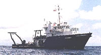
| Platform |
|
||||||||
| Vehicles | None |
||||||||
| Itinerary |
|
||||||||
| Bounds |
|
| Organization |
600 Fourth Street South
St. Petersburg, FL33701-4846
(727) 502-8000
|
||
|---|---|---|---|
| Principal investigators | Lisa L Robbins | ||
| Crew members |
|
||
| Information specialist(s) |
|
| Data category: | Environmental Data, Location-Elevation, Sampling |
|---|---|
| Data type: | CTD, pH, Navigation, Chemistry |
| Equipment | Usage description | Data types | Datasets |
|---|---|---|---|
| GPS | Navigation | 1 | |
| Conductivity, Temperature and Depth (CTD) Logger/Probe | CTD | 1 | |
| Sonde sensor | CO2, Temperature, pH | 1 | |
| Rosette | Chemistry | 1 | |
| Other | Unknown, Meteorology, CTD, Temperature, pH, CO2, Radon, Conductivity, Current, Dissolved Oxygen, Turbidity, Fluorescence, Wave, ORP, Tide, Methane, Depth, Light, Nitrate, Gas Hydrates, Density, Sediment Properties, Osmometic Pressure, Chlorophyll, Nutrients, Pressure | (no data reported) |
| Dataset name | Equipment | Description | Dataset contact |
|---|---|---|---|
| 2013_August_Navigation | GPS | Navigational data collected by the research vessel | Lisa L Robbins |
| 2013_August_Samples_Surface | Conductivity, Temperature and Depth (CTD) Logger/Probe | Seawater surface samples collected in transit | Lisa L Robbins |
| 2013_August_Sonde | Sonde sensor | Temperature, conductivity, salinity and pH data | Lisa L Robbins |
| 2013_August_Samples_Surface | Rosette | Seawater samples of the water column collected at specific sample sites | Lisa L Robbins |