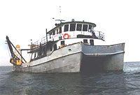
This survey was undertaken to establish if exploitable aggregate resources exist in Massachusetts waters. Following the reconnaissance survey (72001), the ATLANTIC TWIN assisted in Phase II of the survey by collecting vibracores.
Location
Cape Ann Light to Brant Rock, Massachusetts Bay, Massachusetts, United States, North America, North Atlantic;
Summary
Cruise was conducted by Raytheon Company Submarine Signal Division under contract to the Massachusetts Division of Mineral Resources to delineate potential areas of economic deposits of sand and gravel. No USGS ship-board presence; Bob Oldale and John Schlee provided planning and evaluation of samples and seismic survey data. Vibracores: 46.
Info derived
Grain size analysis;
Comments
Cruise was conducted by Raytheon Company Submarine Signal Division under contract to the Massachusetts Division of Mineral Resources to delineate potential areas of economic deposits of sand and gravel. No USGS ship-board presence; Bob Oldale and John Schlee provided planning and evaluation of samples and seismic survey data.
Project = MA Coastal Mineral Inventory, MA Coastal Mineral Inventory
Massachusetts DNR-Division of Mineral Resources; C.F. Willett - Raytheon
Affiliate staff
Raytheon geologist; Alpine Geophysical: James Kotsolis - Vibracore operator, B. Brasher - LORAC navigation party chief; Mass. Division of Mineral Resources: J. Jackimovicz