| Identifier | 1979-016-FA | ||||||||
|---|---|---|---|---|---|---|---|---|---|
| Alternate names | GS 7903-5; GS-79-3-5 | ||||||||
| Purpose | Conduct a geophysical survey from Norfolk, VA, to Charleston, SC. | ||||||||
| Location | Middle Atlantic Bight, Blake Escarpment, South Atlantic Continental Shelf, United States, North America, North Atlantic; | ||||||||
| Summary | XBT: 4; Sonobuoys: 7; Magnetics; Gravity; Seismic lines: 26. | ||||||||
| Info derived | Morphology; | ||||||||
| Comments | No cruise report; information gleaned from ship logs and field data inventory. Original Center People field contained: Dick Sylwester, Barry Irwin, Mike Goldstein, Bob Bowles, Bob Douthard, Jerry McCarthy, Kathy Kent, Charlie Paull, Debbie Hutchinson. | ||||||||
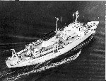
| Platform |
|
||||||||
| Itinerary |
|
||||||||
| Bounds |
|
| Organization |
384 Woods Hole Road
Quissett Campus
Woods Hole, MA02543-1598
(508) 548-8700
|
||||||||||||||||
|---|---|---|---|---|---|---|---|---|---|---|---|---|---|---|---|---|---|
| Principal investigators | William P DillonJohn Grow | ||||||||||||||||
| Crew members |
|
||||||||||||||||
| Affiliate staff | Bob Douthard; U. Miami: Mark Carle; WHOI: Dave Mason, Tom O'Brien, Dan Shaughnessy |
| Data category: | Seismics, Electro-Magnetic, Environmental Data, Location-Elevation |
|---|---|
| Data type: | Air Gun / Water Gun, Boomer, Bubble Gun, Sparker, Gravity, Sonobuoy, Temperature, Navigation |
| Equipment | Usage description | Data types | Datasets |
|---|---|---|---|
| Air gun | Air Gun / Water Gun | (no data reported) | |
| SEI streamer with 40 MD5 hydrophones | Air Gun / Water Gun, Boomer, Bubble Gun, Sparker | 5 | |
| LaCoste-Romberg gravimeter G-179 | Gravity | 1 | |
| Seismic refraction | Sonobuoy | (no data reported) | |
| XBT | Temperature | (no data reported) | |
| Integrated Navigation System | Navigation | 3 |
| Dataset name | Equipment | Description | Dataset contact |
|---|---|---|---|
| 1979-016-FA-SE-001 | SEI streamer with 40 MD5 hydrophones | Collection of paper record displays of seismic data( AIR) for lines | Nancy K. Soderberg |
| 1979-016-FA-SE-002 | SEI streamer with 40 MD5 hydrophones | microfilm of | Nancy K. Soderberg |
| 1979-016-FA-SE-003 | SEI streamer with 40 MD5 hydrophones | analog tape of seismic data | Nancy K. Soderberg |
| 1979-016-FA-SE-004-01 | SEI streamer with 40 MD5 hydrophones | Paper record section of Lines 1, 10, 2, 3, 4, 11, 12, 13, 14, 15, 16, 17, 18, 20, 22, 23, 24, 25, 26, | Nancy K. Soderberg |
| 1979-016-FA-SE-004-02 | SEI streamer with 40 MD5 hydrophones | SEGY data files | Nancy K. Soderberg |
| 1979-016-FA-GP-001 | LaCoste-Romberg gravimeter G-179 | Digital tape(s) of NV, NV-INS, NV-INS,GR,MG, GR-L&R, NV-INS-FINAL, | Nancy K. Soderberg |
| 1979-016-FA-LN-001 | Integrated Navigation System | Navigation trackline plot for field activity 79016 | Nancy K. Soderberg |
| 1979-016-FA-LN-002 | Integrated Navigation System | Digital tape(s) of NV, NV-INS, NV-INS,GR,MG, GR-L&R, NV-INS-FINAL, | Nancy K. Soderberg |
| 1979-016-FA-LN-002-01 | Integrated Navigation System | Zip archive of Navigation Data | Nancy K. Soderberg |