Observe morphology and sedimentary processes of the Blake Escarpment and sample rocks for age dating and paleoenvironmental determinations.
Location
Blake Escarpment, Florida, United States, North America, North Atlantic;
Summary
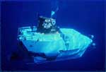
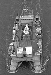
Three continuous transects of the Blake Escarpment east of Florida were made during 10 dives with ALVIN at depths between 1400-4000 m. We observed and sampled outcrops of horizontal strata that are known from multichannel profiles across the dive sites to extend westward beneath the Blake Plateau carbonate platform. The northern end of the Blake Escarpment at the salient of the Blake Spur is a nearly vertical limestone cliff that is pitted and commonly fluted by vertical borings, coated with ferromanganese oxide and heavily encrusted by organisms. Presumably the cliff face is maintained by bioerosion and corrosion, and debris is removed by strong turbulent currents (2 knots). Average slopes were less steep at transects 130 and 200 km south of the Blake Spur, but vertical cliffs as much as 450 m high exist. Talus slopes are common and observation of very large blocks and landward dips of beds suggest collapse of fragments at least several hundreds of meters across. On the southern transect, broad slopes of rippled pteropod sand occur between near-vertical outcrops; a vertical, 160 m cliff of massive limestone at the top of the escarpment and rudists in talus blocks suggest the presence of a Mesozoic reef. Preliminary analysis of calcareous nannofossils shows rocks as old as Early Cretaceous; identification of older rocks is anticipated. Sedimentary structures and components indicate deposition in shallow water. Thousands of meters of subsidence and extensive erosional retreat were required to create the escarpment's present configuration. ALVIN Dives: 10 (#1054-1063); Sample stations: 75.
Info derived
Morphology;Sedimentary processes;
Comments
Original Center People field contained: Bill Dillon - Ch. Sci., Page Valentine, Charles Paull - USGS/SIO, Mahlon Ball.