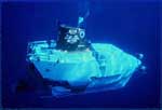
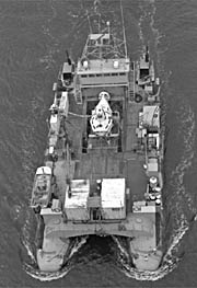
The WHITEFOOT/LULU-ALVIN joint cruise was to recover a subsurface mooring in Lydonia Canyon. The release failed in April 1981 on OCEANUS 95 (FA 81009) when recovery was planned. We dragged for the mooring, severed the wire below the second current meter, and recovered the upper portion. We were unable to recover the deep instrument package after dragging for about 2 days. The near-bottom instrument was a key instrument in the Lydonia Canyon moored array. ALVIN was planning a certification dive near Lydonia Canyon and agreed to try to release the mooring on this dive. A hydraulic chain cutter was mounted on the sample basket of ALVIN; the hand pump was operated by the arm. Because LULU could not easily retrieve the heavy mooring once it surfaced, and because of a tight schedule, WHITEFOOT was chartered to pick up the mooring once ALVIN cut it loose.
Location
Lydonia Canyon, Georges Bank, United States, North America, North Atlantic;
Summary
Mooring recovered: 1 (#211 deployed FA 80034 OCEANUS OC90 Nov. 24 - Dec. 3, 1980). The deep instrument package was recovered! ALVIN had little trouble locating the package with guidance from LULU. We could still transpond to the release on the mooring, and fortunately all flotation was intact. Backup recovery scheme using a rope canister dropped from WHITEFOOT was not needed. Chain was cut relatively easily with hydraulic cutter. One VACM was lost on mooring 211. Apparently we cut the mooring in 2 places while dragging on OCEANUS 95, and intermediate flotation was insufficient to bring the VACM (V111P, Fig. 3) to the surface. We were extremely fortunate to be able to use ALVIN. It was a textbook yet remarkable recovery due to the skill of ALVIN crew. The mooring probably would not have been recovered otherwise. The cruise was delayed for about a month while the cradle for ALVIN aboard LULU was repaired.
Info derived
Time series data;
Comments
Original Center People field contained: WHITEFOOT: William Strahle, Frank Musialowski; LULU: Brad Butman.
Chief Scientist's daily log of ship movement, equipment configurations and data acquisition notes, personnel, trackmap and mooring deployment map. Also includes a schematic of the mooring.