Field Activity 1982-042-FA

Identifier 1982-042-FA
Alternate names LACOSS I
Location western Louisiana Continental Shelf, Louisiana, United States, Gulf of Mexico, North America, North Atlantic;
Summary ORE Boomer data: Lines C1-C49.
Info derived Sea floor map; Morphology;
Comments Project = Louisiana Cooperative Sand Survey, Louisiana Cooperative Sand Survey
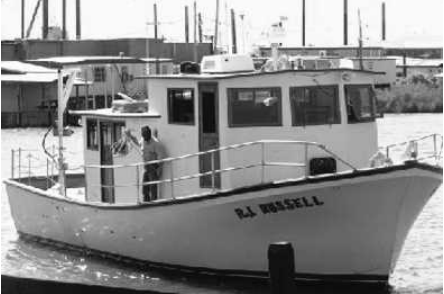
Platform
R J Russell
Itinerary
Start (port not specified) 1982-08-27
End (port not specified) 1982-09-18
Days in the field 6
Bounds
West -93.4
East -93.3
North 29.85
South 29.6

Personnel

Organization
384 Woods Hole Road
Quissett Campus
Woods Hole, MA02543-1598
(508) 548-8700
Principal investigators John West
Crew members
Affiliate principal John Suter

Data types and categories

Data category: Location-Elevation, Seismics
Data type: Navigation, Boomer

Equipment used

Equipment Usage description Data types Datasets
Boomer Boomer (no data reported)
Loran-C Navigation 1
Single channel hydrophone Air Gun / Water Gun, Boomer, Bubble Gun, Sparker, Sub Bottom Profiler 1

Datasets

Datasets produced in this activity

Dataset name Equipment Description Dataset contact
1982-042-FA-LN-001 Loran-C Digital tape(s) of NV, Nancy K. Soderberg
1982-042-FA-SE-001 Single channel hydrophone analog tape of seismic data Nancy K. Soderberg

Publications

Samples collected during this field activity