| Identifier | 1984-027-FA | ||||||||
|---|---|---|---|---|---|---|---|---|---|
| Alternate names | LACOSS V; LACOSS 5 | ||||||||
| Location | Coastal Louisiana Shelf, Louisiana, United States, Gulf of Mexico, North America, North Atlantic; | ||||||||
| Summary | ORE Boomer: Lines TB1,TB3-TB11, TB12, TB23-T45, TB48-TB55, TB58-TB70; TS9-TS12, and TS14-TS15. ORE GeoPulse Datasonics: Lines TB, TB12-TB22, TB46-TB47, TB56-TB57,TB71-TB74; TS13, and TS16-TS29. | ||||||||
| Comments | No cruise report; information derived from analog tape log. Hard copies of Uniboom profiles in St. Petersburg office. Project = Louisiana Cooperative Sand Survey, Louisiana Cooperative Sand Survey | ||||||||
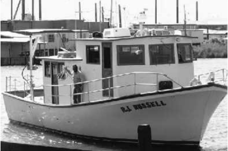
| Platform |
|
||||||||
| Itinerary |
|
||||||||
| Bounds |
|
| Organization |
384 Woods Hole Road
Quissett Campus
Woods Hole, MA02543-1598
(508) 548-8700
|
||||
|---|---|---|---|---|---|
| Principal investigators | John West | ||||
| Crew members |
|
||||
| Affiliate principal | John Suter, Shea Penland, Moslow |
| Data category: | Location-Elevation, Seismics |
|---|---|
| Data type: | Navigation, Boomer, Sub Bottom Profiler |
| Name | Description |
|---|---|
| Geophysics log | Seismic Analog Tape Log (pdf file) Watchstander's log describing seismic analog equipment configuration, line and tape start and end times and comments. |
| Equipment | Usage description | Data types | Datasets |
|---|---|---|---|
| Boomer | Boomer | (no data reported) | |
| Datasonics SST 220 sub-bottom 3.5k | Sub Bottom Profiler | (no data reported) | |
| ORE GeoPulse | Boomer | (no data reported) | |
| Loran-C | Navigation | 7 | |
| Single channel hydrophone | Air Gun / Water Gun, Boomer, Bubble Gun, Sparker, Sub Bottom Profiler | 1 |
| Dataset name | Equipment | Description | Dataset contact |
|---|---|---|---|
| 1984-027-FA-LN-001 | Loran-C | Digital tape(s) of NV, | Nancy K. Soderberg |
| 1984-027-FA-LN-001-01 | Loran-C | Field Cassette 1 Printout (pdf file) Loran-C navigation printout for NorthStar Loran-C navigation cassette 1. | Nancy K. Soderberg |
| 1984-027-FA-LN-001-02 | Loran-C | Field Cassette 2 Printout (pdf file) Loran-C navigation printout for NorthStar Loran-C navigation cassette 2. | Nancy K. Soderberg |
| 1984-027-FA-LN-001-03 | Loran-C | Field Cassette 3 Printout (pdf file) Loran-C navigation printout for copy of NorthStar Loran-C navigation cassette 3. | Nancy K. Soderberg |
| 1984-027-FA-LN-001-04 | Loran-C | Navigation file LACOS11 (txt file) Rescued navigation file from 5-minute-fix plot file with latitude, longitude and time annotation; Aug. 15, 1500, 1984 - Aug. 17, 0350, 1984. | Nancy K. Soderberg |
| 1984-027-FA-LN-001-05 | Loran-C | Navigation file LACOS12 (txt file) Rescued navigation file from 5-minute-fix plot file with latitude, longitude and time annotation; Aug. 17, 0559, 1984 - Aug. 19, 0400, 1984. | Nancy K. Soderberg |
| 1984-027-FA-LN-001-06 | Loran-C | Navigation file LACOS13 (txt file) Rescued navigation file from 5-minute-fix plot file with latitude, longitude and time annotation; Aug. 21, 1045, 1984 - Aug. 23, 0230, 1984. | Nancy K. Soderberg |
| 1984-027-FA-SE-001 | Single channel hydrophone | analog tape of seismic data | Nancy K. Soderberg |