| Identifier | 1986-016-FA | ||||||||
|---|---|---|---|---|---|---|---|---|---|
| Alternate names | ACAD 86-2 | ||||||||
| Purpose | To take bathymetric profiles, distance measurements and samples along profile lines at the barrier island study site on central Isles Dernieres. | ||||||||
| Location | offshore Isles Dernieres, Louisiana, United States, Gulf of Mexico, North America, North Atlantic; | ||||||||
| Summary | Bathymetric profiling offshore to a distance of approx. 12 nm; precision distance measurements offshore to a distance of 1.8 km. | ||||||||
| Info derived | Samples and chemical analysis; Bathymetric maps; | ||||||||
| Comments | Project = Coastal Erosion Program, PMG, Coastal Erosion Program, PMG | ||||||||
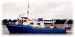
| Platform |
|
||||||||
| Itinerary |
|
||||||||
| Bounds |
|
| Organization |
384 Woods Hole Road
Quissett Campus
Woods Hole, MA02543-1598
(508) 548-8700
|
|---|---|
| Principal investigators | Ronald C. Circe |
| Crew members | |
| Affiliate staff | Ron Circe, USGS, BAMG, Reston, VA; Rob Wertz, USGS, BPMG, Reston, VA |
| Data category: | Sonar, Location-Elevation, Sampling |
|---|---|
| Data type: | Single Beam, Navigation, Geology |
| Name | Description |
|---|---|
| Cruise report | Brief Chief Scientist's report including personnel, purpose, equipment, tabulated information, and map of transect. |
| Navigation log | Printout of navigation with added handwritten notes. |
| Equipment | Usage description | Data types | Datasets |
|---|---|---|---|
| Raytheon DE-719 precision echo sounder | Single Beam | (no data reported) | |
| Gravity corer | Geology | (no data reported) | |
| Megapulse Accufix 500 LORAN-C | Navigation | 1 |
| Dataset name | Equipment | Description | Dataset contact |
|---|---|---|---|
| 1986-016-FA-LN-001 | Megapulse Accufix 500 LORAN-C | Floppy disk(s) containing NV-MEGAPULSE, NV-MEGAPULSE, NV-MEGAPULSE, NV-MEGAPULSE, | Nancy K. Soderberg |