| Identifier | 1986-022-FA | ||||||||
|---|---|---|---|---|---|---|---|---|---|
| Alternate names | CHES 86-1 | ||||||||
| Purpose | Collection of high-resolution seismic reflection and sidescan sonar data in order to define the geology and shallow structure of the Chesapeake Bay. | ||||||||
| Location | central Chesapeake Bay, United States, North America, North Atlantic; | ||||||||
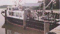
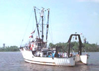
| Summary | Two ships were used for this cruise: R/V DAN MOORE (Cape Fear Tech) for first week; R/V DISCOVERY (MGS) for second week of survey. Cooperators: Virginia Institute of Marine Science (VIMS), Maryland Geological Survey (MGS), and Cape Fear Tech. All equipment performed extremely well with the exception of the sidescan sonar system which failed completely on the first day due to a cable break. Seismic reflection records collected and very good except for areas that contained biogenic gas. Records clearly show entire quaternary and upper part of the Tertiary sequence of deposits. Cruise completed the basic seismic reflection grid between mouth of the bay and the Patuxent River begun by earlier two cruises. | ||||||||
| Comments | Original Center People field contained: Steve Colman, Chief Scientist; Ron Circe; Dave Nichols, Technician. Project = Geology of Chesapeake Bay, Geology of Chesapeake Bay | ||||||||
| Platform |
|
||||||||
| Itinerary |
|
||||||||
| Bounds |
|
| Organization |
384 Woods Hole Road
Quissett Campus
Woods Hole, MA02543-1598
(508) 548-8700
|
||||||
|---|---|---|---|---|---|---|---|
| Principal investigators | Stephen Colman | ||||||
| Crew members |
|
||||||
| Affiliate principal | Jeff Halka, MGS; Woody Hobbs, VIMS | ||||||
| Affiliate staff | Jeff Halka, MGS, Chief Scientist; Woody Hobbs, VIMS, Chief Scientist |
| Data category: | Seismics, Sonar, Location-Elevation |
|---|---|
| Data type: | Boomer, Air Gun / Water Gun, Sparker, Sub Bottom Profiler, Sidescan, Navigation |
| Name | Description |
|---|---|
| Cruise report | Chief Scientist's report including personnel, purpose, equipment, equipment performance, cruise summary, and trackmap. |
| Data inventory | Cruise Curator's inventory of field data. |
| Equipment | Usage description | Data types | Datasets |
|---|---|---|---|
| ORE GeoPulse | Boomer | (no data reported) | |
| Benthos AQ-4 10-element hydrophone streamer | Air Gun / Water Gun, Boomer, Sparker | 2 | |
| Datasonics SST 220 sub-bottom 3.5k | Sub Bottom Profiler | (no data reported) | |
| EG&G Model SMS 960 Seafloor Mapping System | Sidescan | 1 | |
| Loran-C | Navigation | 3 |
| Dataset name | Equipment | Description | Dataset contact |
|---|---|---|---|
| 1986-022-FA-SE-001 | Benthos AQ-4 10-element hydrophone streamer | microfilm of | Nancy K. Soderberg |
| 1986-022-FA-SE-002 | Benthos AQ-4 10-element hydrophone streamer | analog tape of seismic data | Nancy K. Soderberg |
| 1986-022-FA-SO-001 | EG&G Model SMS 960 Seafloor Mapping System | microfilm of | Nancy K. Soderberg |
| 1986-022-FA-LN-001-01 | Loran-C | Composite trackline map with line numbers, dates and times for DISCOVERY 85-2(FA 85031) and DAN MOORE/DISCOVERY 86-1 (FA 86022). | Nancy K. Soderberg |
| 1986-022-FA-LN-002 | Loran-C | Floppy disk(s) containing NV-MEGAPULSE, NAV-MEGAPULSE, NAV-MEGAPULSE, NAV-MEGAPULSE, NAV-MEGAPULSE, NAV-MEGAPULSE, NAV-MEGAPULSE, NAV-MEGAPULSE, NAV-MEGAPULSE, | Nancy K. Soderberg |
| 1986-022-FA-LN-003 | Loran-C | Floppy disk(s) containing NV-MEGAPULSE, NAV-MEGAPULSE, NAV-MEGAPULSE, NAV-MEGAPULSE, NAV-MEGAPULSE, NAV-MEGAPULSE, NAV-MEGAPULSE, NAV-MEGAPULSE, NAV-MEGAPULSE, | Nancy K. Soderberg |