| Identifier | 1987-016-FA | ||||||||
|---|---|---|---|---|---|---|---|---|---|
| Alternate names | ACAD 87-1 | ||||||||
| Purpose | To collect bottom samples offshore Isles Dernieres barrier islands. | ||||||||
| Location | offshore central Louisiana, United States, Gulf of Mexico, North America, North Atlantic; | ||||||||
| Summary | Water depth varied from 3 m to 25 m. I was very impressed by the underway grab sampler. Sidescan sonar: 463 km; Bottom grabs: 225. | ||||||||
| Comments | Project = Coastal Erosion Project, BAMG, Coastal Erosion Project, BAMG | ||||||||
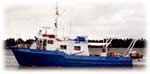
| Platform |
|
||||||||
| Itinerary |
|
||||||||
| Bounds |
|
| Organization |
384 Woods Hole Road
Quissett Campus
Woods Hole, MA02543-1598
(508) 548-8700
|
||
|---|---|---|---|
| Principal investigators | Ronald C. Circe | ||
| Crew members |
|
||
| Affiliate staff | Rob Wertz - USGS BPMG; Steve Underwood - COE; Sonny Maciasz - LGS |
| Data category: | Sonar, Sampling, Location-Elevation |
|---|---|
| Data type: | Sidescan, Biology, Geology, Navigation |
| Name | Description |
|---|---|
| Cruise report | Brief Chief Scientist's cruise report including personnel, equipment, tabulated information, sidescan paper roll and associated sample numbers. |
| Equipment | Usage description | Data types | Datasets |
|---|---|---|---|
| Klein 531 sidescan | Sidescan | 1 | |
| Grab sampler | Biology, Geology | (no data reported) | |
| Loran-C | Navigation | 1 |
| Dataset name | Equipment | Description | Dataset contact |
|---|---|---|---|
| 1987-016-FA-SE-001 | Klein 531 sidescan | analog tape of seismic data | Nancy K. Soderberg |
| 1987-016-FA-LN-001 | Loran-C | Floppy disk(s) containing NV-MEGAPULSE, | Nancy K. Soderberg |