Collect vibracores in Connecticut, Rhode Island, Massachusetts and New Hampshire waters as part of a cooperative offshore, non-energy resource assessment with the U.S. Minerals Management Service (Continental Margins Program).
Location
Long Island Sound, Connecticut, New York, Rhode Island, United States, North America, North Atlantic;
Summary
Eight Long Island Sound sites were targeted during the CT leg. These were cored between 9/15 and 9/21, and the ship then went on to complete the RI, MA and NH legs. Coring targets were selected using seismic data from previous Long Island Sound cruises (AST 85-8, UCONN-84-1, AST 83-2, SO 87-1), and the target locations were confirmed during the cruise using a Uniboom seismic system. The confirming paper seismic records for each core location are archived at the Long Island Sound Resource Center, UCONN-Avery Point. The cores were split, photographed, described and archived at the WHOI core lab in Woods Hole, MA. Dr. Paul Gayes performed more extensive examinations of cores AT 88-2 and AT 88-5. Some of his results are archived at the Long Island Sound Resource Center along with a notebook containing prints and original negatives of the cores, sampling reports and all available paper records of the coring operation, results and related work.
Info derived
Non-energy resource assessment;
Comments
In addition to helping with the assessment of offshore sand and gravel resources, the Long Island Sound cores were located so they would also be useful in sorting out the stratigraphic history of the Sound. This work augmented the coring that took place in 1984 (Cruise AT 84-1). Cores AT 88-2 and AT 88-5 were collected in support of work by Dr. Paul Gayes (Gayes and Bokuniewicz, 1991). No WHSC personnel were involved in this field work. Original Submitted By field contained: Sally Wood Needell / Ralph Lewis.
Project = Continental Margins Program, Continental Margins Program
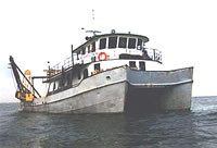
Platform
Atlantic Twin
90 foot steel catamaran hull research vessel with a 7 foot draft.