| Identifier | 1989-018-FA | ||||||||
|---|---|---|---|---|---|---|---|---|---|
| Alternate names | Leg 1 | ||||||||
| Purpose | The objectives are to determine the shallow morphostratigraphy of the Louisiana barrier delta plain using seismic and core information. | ||||||||
| Location | Louisiana, United States, North America, North Atlantic; | ||||||||
| Info derived | Morphology; | ||||||||
| Comments | Information derived from pre-cruise report; no post-cruise report found. | ||||||||
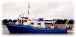
| Platform |
|
||||||||
| Itinerary |
|
||||||||
| Bounds |
|
| Organization |
384 Woods Hole Road
Quissett Campus
Woods Hole, MA02543-1598
(508) 548-8700
|
||
|---|---|---|---|
| Principal investigators | S. Jeffress Williams | ||
| Crew members |
|
||
| Affiliate principal | Shea Penland (LGS - Baton Rouge); Randy McBride (LGS - Baton Rouge) | ||
| Affiliate staff | Jeff Williams (USGS-Reston); Jack Kindinger (USGS-St. Petersburg); Mike Ierardi (USGS-Reston); Shea Penland (LGS - Baton Rouge), Randy McBride (LGS - Baton Rouge), David Pope (LGS - Baton Rouge), Paul Conner (LGS - Baton Rouge), Steven Anderson (LGS - Baton Rouge), Karen Ramsey (LGS - Baton Rouge) |
| Data category: | Seismics, Location-Elevation |
|---|---|
| Data type: | Boomer, Air Gun / Water Gun, Sparker, Sub Bottom Profiler, Navigation |
| Equipment | Usage description | Data types | Datasets |
|---|---|---|---|
| ORE GeoPulse | Boomer | (no data reported) | |
| Benthos AQ-4 10-element hydrophone streamer | Air Gun / Water Gun, Boomer, Sparker | (no data reported) | |
| ORE 140 transceiver/1036 transducer sub-bottom profiler | Sub Bottom Profiler | (no data reported) | |
| Northstar 6000 LORAN-C | Navigation | (no data reported) |