Field Activity 1990-016-FA

Identifier 1990-016-FA
Alternate names W3-90; WTHT90-2
Purpose 
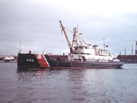
The objective of the program is to make long-term measurements of currents and sediment transport in the vicinity of the proposed ocean outfall in Massachusetts Bay. The purpose of this cruise was to recover and redeploy the instrumented moorings. Samples of bottom sediments are collected on each cruise required to service the instruments. This was the third in a series of 6 cruises during the two year period of the present Joint Funding Agreement between the MA Water Resources Authority and the USGS.
Location Massachusetts Bay, Massachusetts, United States, North America, North Atlantic,
Summary Moorings deployed: 2 (#347 and 348 recovered FA 90041 WHITE HEATH Oct. 23-24, 1990). Moorings recovered: 2 (#340 and 341 deployed FA 90002 WHITE HEATH Mar. 27-29, 1990) .
Info derived Time series data; Samples and chemical analysis; Grain size analysis;
Comments Information derived from cruise report and mooring log. Moorings deployed on March 28, 1990, were recovered on this cruise and replaced with new moorings. Original Center People field contained: Andrea Barbanti - mooring work, sampling; Mike Bothner - mooring work, sampling; Adam Brown - mooring work, sampling; Marinna Martini - mooring work; Carol Parmenter - mooring work, sampling; Richard Rendigs - mooring work, sampling; William Strahle - mooring work; Donald Harrison - sampling. Project = Circulation, Pollutant Transport Studies off MA Coast, Circulation, Pollutant Transport Studies off MA Coast Information from Foghorn: Butman Tripod, subsurface array, VMCM LNB;Van Veen grab sampler;hydraulically damped gravity corer;conventional gravity corer;television camera;
URL
Platform
White Heath
Length: 133 feet; Beam: 30 feet.
Itinerary
Start Boston Coast Guard Base, Boston, MA 1990-07-10
End Boston Coast Guard Base, Boston, MA 1990-07-11
Days in the field 2
Bounds
West -70.79221627
East -70.76762483
North 42.37987881
South 42.3633644

Personnel

Organization
384 Woods Hole Road
Quissett Campus
Woods Hole, MA02543-1598
(508) 548-8700
Principal investigators Michael Bothner
Crew members
Michael Bothner
Scientist, Staff
Richard R Rendigs
Scientist, Staff
Marinna A Martini
Scientist, Staff
Brown, Adam
Scientist, Staff
Parmenter, Carol M.
Scientist, Staff
William J. Strahle
Scientist, Staff
Affiliate staff Andrea Barbanti - mooring work, sampling; Donald Harrison - sampling

Data types and categories

Data category: Imagery, Location-Elevation, Sampling, Time Series, Visual Identification
Data type: Photo, Video, Navigation, Geology, Mooring (physical oceanography), Submersible Observations

Documents: Notes and log books

Name Description
Cruise report Chief Scientist's cruise report with ship, personnel, equipment and data acquisition notes, core and grab sample coordinates, types of analyses to be conducted, and log for video camera used to photograph sampling operation.

Moorings

RCV:340,341; DEP:347,348;

Equipment used

Equipment Usage description Data types Datasets
Slow corer Geology (no data reported)
Van Veen grab sampler Geology (no data reported)
Gravity corer Geology (no data reported)
Video camera - deep sea Video (no data reported)
Loran-C Navigation (no data reported)
Camera- deep sea Photo 1
Sextant Navigation (no data reported)
Bottom platform Mooring (physical oceanography) 1
Submersible Observation Submersible Observations 1

Datasets

Datasets produced in this activity

Dataset name Equipment Description Dataset contact
1990-016-FA-PH-001 Camera- deep sea film collection of TRIPOD 347; 19900710-19901024 Nancy K. Soderberg
1990-016-FA-OM-001 Bottom platform Western Mass Bay mooring data Ellyn Montgomery
1990-016-FA-NL-002 Submersible Observation Audio tape tape for sub dive Nancy K. Soderberg

Publications

Samples collected during this field activity