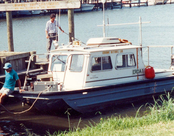
Field Activity 1990-306-FA

Identifier 1990-306-FA
Alternate names ERDA90-2, MB91-1
Purpose To collect geophysical and sedimentological data in the northern Gulf of America (Gulf of Mexico), including shallow subsurface data in the form of high-resolution seismic-reflection profiles (HRSP).
Location Mobile Bay, Alabama
Info derived Sub-bottom profile images
Comments Data were collected between August 12 and August 19, 1990 for ERDA90-2 and May 15 and May 18, 1991 for MB91-1.

Projects
Platform
Erda-1
Length 24 feet.
Itinerary
Start St.Petersburg, FL 1990-08-12
End St.Petersburg, FL 1991-05-18
Bounds
West -88.62707376
East -87.38020229
North 31.15170748
South 30.06259193

Personnel

Organization
600 Fourth Street South
St. Petersburg, FL33701-4846
(727) 502-8000
Principal investigators Jack L Kindinger
Crew members
Jack L Kindinger
Scientist, Staff
Dana S Wiese
Scientist, Staff
Information specialist(s)
James G Flocks
Specialist, Information
Arnell S Forde
Specialist, Information

Data types and categories

Data category: Seismics, Location-Elevation
Data type: Boomer, Navigation

Equipment used

Equipment Usage description Data types Datasets
EG&G Uniboom Acoustic System Sub Bottom Profiler, Boomer (no data reported)
Long range navigation (LORAN) Navigation (no data reported)

Publications

Samples collected during this field activity