Conduct a sidescan sonar survey for 48 hours. Collect samples and video of the sea floor using the robot JASON. The work will be conducted in the dump site and in a control area to the east. The sediment samples will be used for studies of benthic infauna, microbiology, heavy metal and organic geochemistry. The purpose of the sampling is to determine the distribution of the chemical enrichments from sewage sludge in the bottom sediments with distance from this dump site (located between 2,250-2,750 m water depth).
Location
Deep Water Dump Site DWDS 106, New Jersey Continental Slope, United States, North America, North Atlantic;
Comments
Added AMS-120 based on data tapes found related to the activity.
Platform
Betty Chouest
Length: 75 meters; Beam: 15 meters.
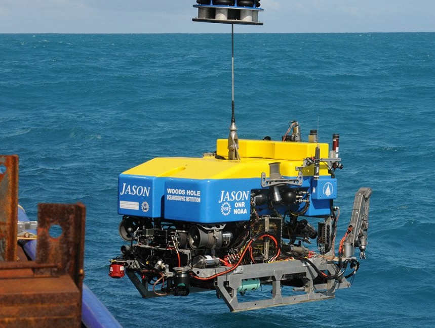
ROV Jason
Two-body ROV system. A 10-kilometer (6-mile) reinforced fiber-optic cable delivers electrical power and commands from the ship through Medea and down to Jason, which then returns data and live video imagery. Medea serves as a shock absorber, buffering Jason from the movements of the ship, while providing lighting and a bird’s eye view of the ROV during seafloor operations. Jason is equipped with sonars, video and still imaging systems, lighting, and numerous sampling systems.