| Identifier | 1991-022-FA | ||||||||
|---|---|---|---|---|---|---|---|---|---|
| Alternate names | VERE91-1 | ||||||||
| Purpose | To obtain and quantitatively interpret the sedimentary record of changing climate and limnology in Lake Baikal. | ||||||||
| Location | Lake Baikal, Siberia, Russia, Asia; | ||||||||
| Summary | Benthos gravity cores: 29; box cores: 19; large-diameter piston cores: 36; seismic reflection profiles: 2060 km. | ||||||||
| Comments | Original Center People field contained: Steve Colman - Co-Ch. Sci.; Susan Carter - geologist; Dave Nichols - seismic specialist; Rick Rendigs - geologist. Project = Global Change Sratigraphy, Global Change Sratigraphy Information from Foghorn: Seismic reflection 3.5 kHz, water gun, HP 8-track analog recorder, piston corer (10 cm), benthos gravity corer, box corer; | ||||||||
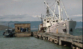
| Platform |
|
||||||||
| Itinerary |
|
||||||||
| Bounds |
|
| Organization |
384 Woods Hole Road
Quissett Campus
Woods Hole, MA02543-1598
(508) 548-8700
|
||||||||
|---|---|---|---|---|---|---|---|---|---|
| Principal investigators | Stephen Colman | ||||||||
| Crew members |
|
||||||||
| Affiliate principal | Paul Hearn - USGS-Reston; E. Karabanov - Limnological Institute, Irkutsk | ||||||||
| Affiliate staff | Paul Hearn - Co-Ch. Sci., USGS-Reston; Edward Callender - geochemist, USGS-WRD-Reston; Hans Nelson - geologist, USGS-PMG-MP; Kevin O'Toole - marine tech., USGS-PMG-MP; James Broda - research assoc., WHOI; Anne Felton - geologist, BMR Australia; John King - professor, URI; Cynthia Pilskaln - MBARI; E. B. Karabanov - LI Siberia; A. Bardardinov - LI Siberia; L. Granina - LI Siberia; A. Gvozdkov - IG Siberia; E. Seleznova - USSR Ministry of Geology |
| Data category: | Biological Field Study, Location-Elevation, Sampling, Seismics |
|---|---|
| Data type: | Experiments (biological), Navigation, Biology, Geology, Air Gun / Water Gun, Sub Bottom Profiler |
| Name | Description |
|---|---|
| Cruise report | Chief Scientist's cruise report including personnel, purpose, equipment and equipment performance, cruise summary and conclusions, trackmap, table of core locations. |
| Data inventory | Cruise curator's inventory of field data, indicating type, medium, and quantity. |
| Navigation log | Navigation log containing line list, line number, date, time, course, speed, latitude, longitude, start and end of lines and other comments and observations. |
| Equipment | Usage description | Data types | Datasets |
|---|---|---|---|
| 3.5 kHz | Sub Bottom Profiler | (no data reported) | |
| Water gun (wh) | Air Gun / Water Gun | (no data reported) | |
| Gravity corer | Geology | (no data reported) | |
| Box corer | Biology, Geology | (no data reported) | |
| Magellan PRO 1000 GPS | Navigation | 1 | |
| Single channel hydrophone | Air Gun / Water Gun, Boomer, Bubble Gun, Sparker, Sub Bottom Profiler | 4 | |
| Piston corer | Geology | (no data reported) |
| Dataset name | Equipment | Description | Dataset contact |
|---|---|---|---|
| 1991-022-FA-LN-001 | Magellan PRO 1000 GPS | Navigation trackline plot for field activity 91022 | Nancy K. Soderberg |
| 1991-022-FA-SE-001 | Single channel hydrophone | Collection of paper record displays of seismic data( H2O) for lines | Nancy K. Soderberg |
| 1991-022-FA-SE-002 | Single channel hydrophone | microfilm of | Nancy K. Soderberg |
| 1991-022-FA-SE-003 | Single channel hydrophone | analog tape of seismic data | Nancy K. Soderberg |
| Water gun data | Single channel hydrophone | Linda P McCarthy |