| Identifier | 1992-004-FA | ||||||||
|---|---|---|---|---|---|---|---|---|---|
| Alternate names | 92-04; ALB9204 | ||||||||
| Purpose | Echo sounding and sidescan sonar surveys of selected areas on the northern edge of Georges Bank to map sedimentary environments and biological habitats. | ||||||||
| Location | northern edge of Georges Bank, United States, North America, North Atlantic; | ||||||||
| Comments | Project = EEZ shelf mapping - Eastern Georges Bank, EEZ shelf mapping - Eastern Georges Bank | ||||||||
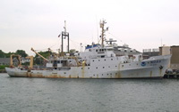
| Platform |
|
||||||||
| Itinerary |
|
||||||||
| Bounds |
|
| Organization |
384 Woods Hole Road
Quissett Campus
Woods Hole, MA02543-1598
(508) 548-8700
|
||||||||||||
|---|---|---|---|---|---|---|---|---|---|---|---|---|---|
| Principal investigators | Page C Valentine | ||||||||||||
| Crew members |
|
||||||||||||
| Affiliate staff | NMFS - Greg Lough, Alex Penkrat, Geoff Laurence |
| Data category: | Sonar, Imagery, Location-Elevation |
|---|---|
| Data type: | Sidescan, Single Beam, Photo, Video, Navigation |
| Name | Description |
|---|---|
| Cruise report | Chief Scientist's cruise report including personnel, purpose, equipment, tabulated information, station locations, and trackmap. |
| Navigation log | Log containing start and end of navigation on 3.5 inch floppy disks. Also documents start and end of survey lines and other cruise comments. |
| Equipment | Usage description | Data types | Datasets |
|---|---|---|---|
| Klein 531 sidescan | Sidescan | (no data reported) | |
| Q-MIPS sidescan sonar system | Sidescan | (no data reported) | |
| 12 kHz | Single Beam | (no data reported) | |
| Osprey camera system | Photo, Video | (no data reported) | |
| GPS (wh) | Navigation | 1 | |
| Loran-C | Navigation | (no data reported) |
| Dataset name | Equipment | Description | Dataset contact |
|---|---|---|---|
| 1992-004-FA-LN-001-01 | GPS (wh) | GPS navigation data. | Nancy K. Soderberg |