| Identifier | 1992-005-FA | ||||||||
|---|---|---|---|---|---|---|---|---|---|
| Alternate names | ARMN92-1 | ||||||||
| Purpose | Collect sidescan sonar data and ground truth (with grab samples) in order to complete a data set showing the surficial sedimentary environments in the research area. | ||||||||
| Location | Massachusetts Bay, Massachusetts, United States, North America, North Atlantic, | ||||||||
| Info derived | Sea floor map; | ||||||||
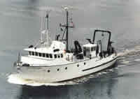
| Platform |
|
||||||||
| Itinerary |
|
||||||||
| Bounds |
|
| Organization |
384 Woods Hole Road
Quissett Campus
Woods Hole, MA02543-1598
(508) 548-8700
|
||||||||||||||||
|---|---|---|---|---|---|---|---|---|---|---|---|---|---|---|---|---|---|
| Principal investigators | Ronald C. Circe | ||||||||||||||||
| Crew members |
|
||||||||||||||||
| Affiliate staff | Nicole Moser (USGS-Reston, VA) |
| Data category: | Sonar, Seismics, Sampling, Location-Elevation |
|---|---|
| Data type: | Boomer, Sidescan, Sub Bottom Profiler, Biology, Geology, Single Beam, Navigation |
| Name | Description |
|---|---|
| Cruise log | Chief Scientist's log describing cruise activities, personnel, equipment performance and configuration, data acquisition problems, sample locations |
| Data inventory | Curator's list of field data collected. |
| Sample log | Grab Sampling Operations Log |
| Q-Mips log | Sidescan sonar logbook containing line start and end times, file names, equipment configuration, repairs, performance. |
| Navigation log | Loran navigation logbook containing day and time, line number, latitude, longitude, course, speed, disk number, and acquisition notes. |
| Navigation log | Printout from navigation system with handwritten annotations. |
| Equipment | Usage description | Data types | Datasets |
|---|---|---|---|
| GeoPulse uniboom | Boomer | (no data reported) | |
| Single channel hydrophone | Air Gun / Water Gun, Boomer, Bubble Gun, Sparker, Sub Bottom Profiler | 3 | |
| Klein 531 sidescan | Sidescan | 2 | |
| Q-MIPS sidescan sonar system | Sidescan | (no data reported) | |
| Grab sampler | Biology, Geology | (no data reported) | |
| ODOM 200 kHz depth recorder | Single Beam | (no data reported) | |
| 3.5 kHz | Sub Bottom Profiler | (no data reported) | |
| GPS (wh) | Navigation | 5 | |
| Loran-C | Navigation | 5 |
| Dataset name | Equipment | Description | Dataset contact |
|---|---|---|---|
| 1992-005-FA-SE-001 | Single channel hydrophone | Collection of paper record displays of seismic data( GEOP) for lines | Nancy K. Soderberg |
| 1992-005-FA-SE-002 | Single channel hydrophone | VHS digital tapes for line(s) 1, 1,2, 3, 3, 4,5, 5,6, 6,7, 7, 8, 8,9, 9,10, 10,11, 11,12, 12,13,14, 16, 17, 17,18, 18, 18,19, 19,20, 20,28, 28,32, 32, | Nancy K. Soderberg |
| 1992-005-FA-SE-003 | Single channel hydrophone | microfilm of | Nancy K. Soderberg |
| 1992-005-FA-SO-001 | Klein 531 sidescan | microfilm of | Nancy K. Soderberg |
| 1992-005-FA-SO-003 | Klein 531 sidescan | Digital tape(s) of SSS-EG+G LINE 3-14, SSS-EG+G LINE 15-32, | Nancy K. Soderberg |
| 1992-005-FA-LN-001-01 | GPS (wh) | Complete ship movement trackmap with 5 minute fixes and line numbers, scale 1:80,000. | Nancy K. Soderberg |
| 1992-005-FA-LN-001-02 | GPS (wh) | Complete ship movement track map with 5 minute fixes and line numbers, scale 1:100,000. | Nancy K. Soderberg |
| 1992-005-FA-LN-001-03 | GPS (wh) | Trackline data only with 5 minute fixes and line numbers, scale 1:80,000. | Nancy K. Soderberg |
| 1992-005-FA-LN-001-04 | GPS (wh) | Trackline data only with 5 minute fixes and line numbers, scale 1:100,000. | Nancy K. Soderberg |
| 1992-005-FA-LN-002-06 | GPS (wh) | Raw navigation data | Nancy K. Soderberg |
| 1992-005-FA-LN-002-01 | Loran-C | Edited 10-second Loran field navigation for May 6 - May 9, 1992. | Nancy K. Soderberg |
| 1992-005-FA-LN-002-02 | Loran-C | Edited 10-second Loran field navigation for May 9 - May 12, 1992. | Nancy K. Soderberg |
| 1992-005-FA-LN-002-03 | Loran-C | Edited 10-second Loran field navigation for May 12 - May 14, 1992. | Nancy K. Soderberg |
| 1992-005-FA-LN-002-04 | Loran-C | Edited 10-second Loran field navigation for May 14, 1992. | Nancy K. Soderberg |
| 1992-005-FA-LN-002-05 | Loran-C | Loran navigation printout every 5 minutes containing Julian day, time, latitude, longitude, time delays, course, speed, etc. | Nancy K. Soderberg |