| Identifier | 1992-015-FA | ||||||||
|---|---|---|---|---|---|---|---|---|---|
| Alternate names | VERE92-2 | ||||||||
| Purpose | To obtain and quantitatively interpret the sedimentary record of changing climate and limnology in Lake Baikal by collecting high-resolution seismic reflection data to delineate the sedimentary environments beneath the lake, defining how these environments have responded to climate change, and locating and correlating the best sites for coring. | ||||||||
| Location | Selenga Delta, Buguldeika, Academician Ridge, Maloye Marye, Lake Baikal, Siberia, Russia, USSR, Asia; | ||||||||
| Summary | See scanned cruise report. | ||||||||
| Comments | Original Center People field contained: S. Colman, P. Hearn, R. Seal, H. Nelson, S. Carter, K. Parolski, R. Rendigs, J. Allen. Project = Global Change Stratigraphy, Global Change Stratigraphy Information from Foghorn: Russian: Gravity corer, box corer; WHOI: 8-cm piston corer; Seismic reflection: 3.5 kHz, water gun;HP 8-track analogue recorder; | ||||||||
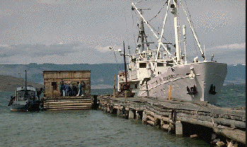
| Platform |
|
||||||||
| Itinerary |
|
||||||||
| Bounds |
|
| Organization |
384 Woods Hole Road
Quissett Campus
Woods Hole, MA02543-1598
(508) 548-8700
|
||||||||
|---|---|---|---|---|---|---|---|---|---|
| Principal investigators | Stephen Colman | ||||||||
| Crew members |
|
||||||||
| Affiliate principal | E.B. Karabanov, Limnolog. Inst., Irkutsk | ||||||||
| Affiliate staff | P. Hearn, R. Seal, H. Nelson, J. Allen; URI: J. Peck; Limol Inst.: E. Karabanov, A. Bardardinov, L. Granina, V. Kochetkov, O. Levina, O. Khlistov, S. Bazileva, E. Stolbova, E. Kapnakova; Irkutsk Poly.: P. Mekhonoshin; Inst. Geog. - Cart.: P. Yermikova |
| Data category: | Biological Field Study, Location-Elevation, Sampling, Seismics |
|---|---|
| Data type: | Experiments (biological), Navigation, Biology, Geology, Sub Bottom Profiler, Air Gun / Water Gun |
| Name | Description |
|---|---|
| Cruise report | Chief Scientist's cruise report including personnel, purpose, equipment and equipment performance, narrative of cruise operations, problems encountered, and summary. Also has table of core locations and trackmaps. |
| Equipment | Usage description | Data types | Datasets |
|---|---|---|---|
| Gravity corer | Geology | (no data reported) | |
| Piston corer | Geology | (no data reported) | |
| Box corer | Biology, Geology | 1 | |
| GPS (wh) | Navigation | 2 | |
| 3.5 kHz | Sub Bottom Profiler | (no data reported) | |
| Single channel hydrophone | Air Gun / Water Gun, Boomer, Bubble Gun, Sparker, Sub Bottom Profiler | 4 | |
| Water gun (wh) | Air Gun / Water Gun | (no data reported) |
| Dataset name | Equipment | Description | Dataset contact |
|---|---|---|---|
| 1992-015-FA-SC-001 | Box corer | CORE samples | Brian Buczkowski |
| 1992-015-FA-LN-001 | GPS (wh) | Navigation trackline plot for field activity 92015 | Nancy K. Soderberg |
| 1992-015-FA-LN-002-01 | GPS (wh) | Raw navigation data files. | Nancy K. Soderberg |
| 1992-015-FA-SE-001 | Single channel hydrophone | Collection of paper record displays of seismic data( 3.5K) for lines | Nancy K. Soderberg |
| 1992-015-FA-SE-002 | Single channel hydrophone | microfilm of | Nancy K. Soderberg |
| 1992-015-FA-SE-003 | Single channel hydrophone | analog tape of seismic data | Nancy K. Soderberg |
| Water gun data | Single channel hydrophone | Linda P McCarthy |