| Identifier | 1994-001-FA | ||||||||
|---|---|---|---|---|---|---|---|---|---|
| Alternate names | Leg 1 | ||||||||
| Purpose | Collect sidescan sonar and bathymetric data within the area designated as Gray's Reef National Marine Sanctuary, 25 miles southeast of Savannah, GA. | ||||||||
| Location | Gray's Reef National Marine Sanctuary, Georgia, United States, North America, North Atlantic; | ||||||||
| Info derived | Sea floor map; | ||||||||
| Comments | Project = Grays Reef NMS, Grays Reef NMS | ||||||||
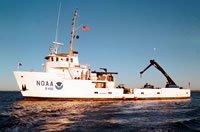
| Platform |
|
||||||||
| Itinerary |
|
||||||||
| Bounds |
|
| Organization |
384 Woods Hole Road
Quissett Campus
Woods Hole, MA02543-1598
(508) 548-8700
|
||||||||
|---|---|---|---|---|---|---|---|---|---|
| Principal investigators | William W Danforth | ||||||||
| Crew members |
|
||||||||
| Affiliate principal | Lt. Cheryl Callahan - NOAA | ||||||||
| Affiliate staff | Lt. Cheryl Callahan, Rick Koehler - NOAA |
| Data category: | Location-Elevation, Sonar |
|---|---|
| Data type: | Navigation, Sidescan, Single Beam |
| Name | Description |
|---|---|
| Cruise report | Chief Scientist's report including personnel, purpose, equipment, tabulated information. |
| Q-Mips log | Q-Mips logs containing line number and file name, start and end of lines, data acquisition notes. |
| Equipment | Usage description | Data types | Datasets |
|---|---|---|---|
| Klein 531 sidescan | Sidescan | 1 | |
| Q-MIPS sidescan sonar system | Sidescan | (no data reported) | |
| ODOM 200 kHz depth recorder | Single Beam | (no data reported) | |
| DGPS | Navigation | 1 |
| Dataset name | Equipment | Description | Dataset contact |
|---|---|---|---|
| 1994-001-FA-SO-001 | Klein 531 sidescan | Digital tape(s) of SSS/L1-4, SSS/L5-6, SSS/L7-10, SSS/L11-22, SSS/L23-36, SSS/L37-51, SSS/L52-59, BATHY L1-4, | Nancy K. Soderberg |
| 1994-001-FA-LN-001 | DGPS | Floppy disk(s) containing NAV-DGPSL1-4, NAV-DGPSL4-21, NAV-DGPSL21-36, NAV-DGPSL49-59, | Nancy K. Soderberg |