| Identifier | 1994-007-FA | ||||||||
|---|---|---|---|---|---|---|---|---|---|
| Alternate names | FER 94-3 | ||||||||
| Purpose | Collection of seismic reflection data for determining the geologic framework of Stellwagen Bank, Tillies Bank and Tillies Basin. | ||||||||
| Location | Cape Cod Bay, Massachusetts Bay, Stellwagen Bank, Tillies Bank, Tillies Basin, Massachusetts, United States, North America, North Atlantic; | ||||||||
| Summary | The cruise was very successful in accomplishing all the original "landslide" expectations for total trackline coverage. Data quality was excellent and overall resolution of the reflectors was enhanced by displaying the data on two channels of the EPC recorder at different sweep rates. Interpretation of the acoustic basement reflectors should be possible from this data set resulting in a more complete understanding of the geologic framework of Stellwagen Bank. Transect lines: 32. | ||||||||
| Comments | Original Center People field contained: Rick Rendigs - Ch. Sci., Dave Nichols - seismics, VeeAnn Cross - seismics. Project = Stellwagen Bank Sanctuary, Stellwagen Bank Sanctuary | ||||||||
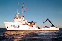
| Platform |
|
||||||||
| Itinerary |
|
||||||||
| Bounds |
|
| Organization |
384 Woods Hole Road
Quissett Campus
Woods Hole, MA02543-1598
(508) 548-8700
|
||||||
|---|---|---|---|---|---|---|---|
| Principal investigators | Richard R RendigsRobert N. Oldale | ||||||
| Crew members |
|
||||||
| Affiliate staff | Byron Stone - USGS-Hartford, CT |
| Data category: | Location-Elevation, Seismics |
|---|---|
| Data type: | Navigation, Air Gun / Water Gun, Boomer |
| Name | Description |
|---|---|
| Cruise Report and Navigation log | Chief Scientist cruise report including personnel, purpose, equipment, tabulated information, start and end of line locations, cruise comments. Also has trackmap and waypoint locations. DGPS navigation log containing line number, start and end times, latitude, longitude, course, speed, disk number, and acquisition notes. |
| Seismic log | Watergun log containing line number, Julian day, start and end times, equipment configuration and performance, data acquisition notes, and geologic observations. |
| Cruise report | Chief Scientist cruise report including personnel, purpose, equipment, tabulated information, start and end of line locations, cruise comments. Also has trackmap and waypoint locations. |
| Equipment | Usage description | Data types | Datasets |
|---|---|---|---|
| DGPS | Navigation | 5 | |
| Water gun (wh) | Air Gun / Water Gun | (no data reported) | |
| Boomer | Boomer | (no data reported) | |
| Single channel hydrophone | Air Gun / Water Gun, Boomer, Bubble Gun, Sparker, Sub Bottom Profiler | 4 |
| Dataset name | Equipment | Description | Dataset contact |
|---|---|---|---|
| 1994-007-FA-LN-001 | DGPS | DGPS Navigation data in text format: 8 files. | Nancy K. Soderberg |
| 1994-007-FA-LN-001-01 | DGPS | DGPS Navigation Printout | Nancy K. Soderberg |
| 1994-007-FA-LN-001-02 | DGPS | Processed navigation data in text file format. | Gregory K Miller |
| 1994-007-FA-LN-001-03 | DGPS | Differential Loran navigation printout containing Julian day, 5-minute fixes, latitude, longitude, and disk number. | Gregory K Miller |
| 1994-007-FA-LN-002 | DGPS | Floppy disk(s) containing NAV-GPS L01-04, NAV-GPS L04-14, NAV-GPS L14-21, NAV-GPS L21-26, NAV-GPS + MARKFILE, | Nancy K. Soderberg |
| 1994-007-FA-SE-001 | Single channel hydrophone | Single channel seismic data: 32 tracklines (650 km) in SEG-Y format on 3 8mm tapes. | Nancy K. Soderberg |
| 1994-007-FA-SE-001-01 | Single channel hydrophone | Best basic version (processed) seismic data in SEG-Y format. | David S Foster |
| 1994-007-FA-SE-002 | Single channel hydrophone | microfilm of | Nancy K. Soderberg |
| SEGY data | Single channel hydrophone | Linda P McCarthy |