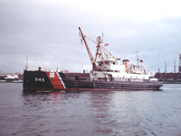
The objective of the program is to conduct long-term monitoring of currents, sediment transport, and physical/chemical characteristics of sediments in western Massachusetts Bay. This cruise will be the 17th in a program jointly funded by the USGS and the Massachusetts Water Resources Authority. The U.S. Coast Guard is generously providing ship time and at-sea support. Time-series sediment traps and a remotely operated suspended matter sampler will be deployed on the subsurface mooring.
Location
Massachusetts Bay, Massachusetts, United States, North America, North Atlantic,
Summary
Moorings recovered: 2 (#445 and 446 deployed FA 94015 WHITE HEATH Oct. 4-5, 1994). Moorings deployed: 3 (#450, 451 and 452, all recovered FA 95032 WHITE HEATH Jun. 13-14, 1995).
Info derived
Time series data; Samples and chemical analysis;
Comments
Information derived from pre-cruise report and mooring logs; no post-field activity report found. Original Center People field contained: Mike Bothner (Recovery and Deployment; Sediment sampling and subsampling), Michael Casso (Recovery and Deployment; Sediment sampling and subsampling), Peter Gill (Recovery and Deployment; Sediment sampling and subsampling), Marinna Martini (Recovery and Deployment), Joseph Newell (Recovery and Deployment), Richard Rendigs (Recovery and Deployment; Sediment sampling and subsampling), William Strahle (Recovery and Deployment), Brenton Taylor (Recovery and Deployment; Sediment sampling and subsampling).
Information from Foghorn: Damped corer;Osprey video camera system;Anderson trap;Upright refrigerator;
Wendy Leo (MWRA - Recovery and Deployment; Sediment sampling and subsampling), Fred Sayles (WHOI - Sediment sampling and subsampling), Joanne Goudreau (WHOI - Sediment sampling and subsampling), Steve Smith (WHOI - Sediment sampling and subsampling)
Data types and categories
Data category:
Imagery, Location-Elevation, Sampling, Time Series