| Identifier | 1996-002-FA | ||||||||
|---|---|---|---|---|---|---|---|---|---|
| Alternate names | SO108 | ||||||||
| Purpose | Image the crustal structure of the Cascadia continental margin as part of the earthquake hazard assessment in the area. | ||||||||
| Location | offshore Washington, Oregon, United States, North America, North Pacific; | ||||||||
| Comments | Project = Cascadia Region Seismic Experiment, Cascadia Region Seismic Experiment | ||||||||
| URL | |||||||||
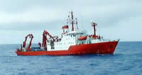
| Platform |
|
||||||||
| Itinerary |
|
||||||||
| Bounds |
|
| Organization |
384 Woods Hole Road
Quissett Campus
Woods Hole, MA02543-1598
(508) 548-8700
|
||||
|---|---|---|---|---|---|
| Principal investigators | Uri Ten Brink | ||||
| Crew members |
|
| Data category: | Seismics |
|---|---|
| Data type: | Ocean Bottom Seismometer |
| Equipment | Usage description | Data types | Datasets |
|---|---|---|---|
| Ocean Bottom Seismometer | Ocean Bottom Seismometer | 2 |
| Dataset name | Equipment | Description | Dataset contact |
|---|---|---|---|
| 1996-002-FA-SE-001 | Ocean Bottom Seismometer | Digital tape(s) of OBS-RAW-DEPLY1, OBS-RAW-DEPLY2, OBS-RAW-DEPLY3, OBS-RAW-DEPLY4, OBS-RAW-DEPLY5, | Nancy K. Soderberg |
| 1996-002-FA-SE-002 | Ocean Bottom Seismometer | CD ROM disk of OBS/ RL1-5, SEGY, OBS/ L7-9, SEGY, OBS/ L10, SEGY, OBS/ L10, SEGY, OBS/ L11, SEGY, OBS/ L11, SEGY, OBS/ L11, SEGY, OBS/ L12, SEGY, OBS/ L12, SEGY, OBH/RL 1-6,8,9,GEOMAR, OBH/RL 7,10, GEOMAR, OBH/RL 11, GEOMAR, OBH/RL 12, GEOMAR, | Nancy K. Soderberg |