| Identifier | 1996-040-FA | ||||||||
|---|---|---|---|---|---|---|---|---|---|
| Purpose | High-resolution sea floor mapping nearshore Fire Island, New York. | ||||||||
| Location | inner shelf out 5 nm, Fire Island, New York, United States, North America, North Atlantic; | ||||||||
| Comments | Project is a continuation of USGS high-resolution sea-floor mapping efforts off the NY-NJ Metropolitan area. Project = EEZ Shelf Mapping; New York Metropolitan Region, EEZ Shelf Mapping; New York Metropolitan Region | ||||||||
| URL | |||||||||
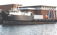
| Platform |
|
||||||||
| Itinerary |
|
||||||||
| Bounds |
|
| Organization |
384 Woods Hole Road
Quissett Campus
Woods Hole, MA02543-1598
(508) 548-8700
|
||||||||||||||||||
|---|---|---|---|---|---|---|---|---|---|---|---|---|---|---|---|---|---|---|---|
| Principal investigators | William C Schwab | ||||||||||||||||||
| Crew members |
|
||||||||||||||||||
| Information specialist(s) |
|
||||||||||||||||||
| Affiliate principal | Steve Couch - USACOE |
| Data category: | Location-Elevation, Seismics, Sonar, Sampling, Imagery |
|---|---|
| Data type: | Boomer, Navigation, Sub Bottom Profiler, Sidescan, Biology, Geology, Photo, Video |
| Name | Description |
|---|---|
| Navigation log | Navigation log containing lines numbers, start and end times, diskette changes, data acquisition notes, station times, trackmap. |
| Equipment | Usage description | Data types | Datasets |
|---|---|---|---|
| GeoPulse uniboom | Boomer | (no data reported) | |
| Benthos AQ-4 10-element hydrophone streamer | Air Gun / Water Gun, Boomer, Sparker | 2 | |
| SIS1000 Chirp Sonar | Sub Bottom Profiler | 3 | |
| DGPS | Navigation | 3 | |
| 3.5 kHz | Sub Bottom Profiler | (no data reported) | |
| SIS1000 Sidescan sonar | Sidescan | (no data reported) | |
| ISIS | Sidescan | (no data reported) | |
| Grab sampler | Biology, Geology | 1 | |
| Camera- deep sea | Photo | (no data reported) | |
| Video camera - deep sea | Video | (no data reported) |
| Dataset name | Equipment | Description | Dataset contact |
|---|---|---|---|
| 1996-040-FA-SE-001-01 | Benthos AQ-4 10-element hydrophone streamer | Boomer Subbottom Data - SEG-Y data files and images. | David S Foster |
| Boomer seismic data | Benthos AQ-4 10-element hydrophone streamer | Linda P McCarthy | |
| 1996-040-FA-SE-001-02 | SIS1000 Chirp Sonar | CHIRP Subbottom Data - SEG-Y data files and images. | David S Foster |
| 1996-040-FA-SE-002 | SIS1000 Chirp Sonar | Remastered DVD disk of Chirp subbottom data, lines 1-79. | Linda P McCarthy |
| Chirp seismic data | SIS1000 Chirp Sonar | Linda P McCarthy | |
| 1996-040-FA-LN-001-01 | DGPS | Processed navigation | Nancy K. Soderberg |
| Boomer navigation | DGPS | Linda P McCarthy | |
| Chirp navigation | DGPS | Linda P McCarthy | |
| 1996-040-FA-SC-001 | Grab sampler | GRAB samples | Brian Buczkowski |