Identifier
1998-018-FA
Purpose
Sampling, video, photography of the sea bed; biologial habitat surveys with submersible.
Location
eastern Georges Bank, United States, Canada, North America, North Atlantic;
Summary
12 submersible dives (photo and video); 12 biol. dredge stations; 10 amphipod traps; 26 photo/video stations.
Info derived
Grain size analysis; Habitat maps;
Comments
Project = Georges Bank Habitats Project, Georges Bank Habitats Project
Information from Foghorn: Video, photo, sampling system with winch, P-code navigation, Geolink software w/computer;
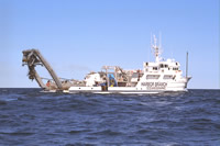
Platform
Edwin Link168 feet
Itinerary
Start
Woods Hole, MA
1998-08-14
End
Gloucester, MA
1998-08-23
Days in the field
8
Bounds
West
-66.53
East
-66.416
North
42.25
South
41.75
Show or hide map Hide layers