| Identifier | 1999-011-FA | ||||||||
|---|---|---|---|---|---|---|---|---|---|
| Alternate names | DLWR9911 | ||||||||
| Purpose | Sampling (video, photo, sediment) and sub-bottom profiling. | ||||||||
| Location | Stellwagen Bank, Massachusetts, United States, North America, Gulf of Maine, North Atlantic, | ||||||||
| Summary | Short stop in Boston on Mar. 21 to exchange personnel via small boat. Total stations 104; video and photo 104; sediment samples 82 stations. Sub-bottom profiling 425 km. | ||||||||
| Comments | Original Center People field contained: At sea: Page Valentine, Dann Blackwood, Jessica Baker, Terry Unger, Ken Parolski, Tom O'Brien, Nancy Soderberg, Barbara Seekins, Dave Foster; Mob/demob: Joe Newell, Bob Barton. Project = Stellwagen Bank NMS Mapping Project, Stellwagen Bank NMS Mapping Project Information from Foghorn: video/photo sampling system;big blue winch;P-code navigation w/bridge monitor;geolink;SIS 1000 sub-bottom with winch;small van;at-sea sub-bottom processing; | ||||||||
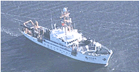
| Platform |
|
||||||||
| Itinerary |
|
||||||||
| Bounds |
|
| Organization |
384 Woods Hole Road
Quissett Campus
Woods Hole, MA02543-1598
(508) 548-8700
|
||||||||||||||||||||||
|---|---|---|---|---|---|---|---|---|---|---|---|---|---|---|---|---|---|---|---|---|---|---|---|
| Principal investigators | Page C Valentine | ||||||||||||||||||||||
| Crew members |
|
||||||||||||||||||||||
| Information specialist(s) |
|
||||||||||||||||||||||
| Affiliate principal | Peter Auster, James Lindholm - NURP/UCONN | ||||||||||||||||||||||
| Affiliate staff | Peter Auster, James Lindholm |
| Data category: | Imagery, Sampling, Seismics, Location-Elevation |
|---|---|
| Data type: | Video, Biology, Geology, Photo, Sub Bottom Profiler, Navigation |
| Equipment | Usage description | Data types | Datasets |
|---|---|---|---|
| Video camera - deep sea | Video | (no data reported) | |
| Camera- deep sea | Photo | 3 | |
| 3.5 kHz | Sub Bottom Profiler | (no data reported) | |
| DGPS | Navigation | (no data reported) | |
| SeaBOSS | Surveys (biological), Experiments (biological), Species ID, Photo, Video, Geology, Biology | 8 |
| Dataset name | Equipment | Description | Dataset contact |
|---|---|---|---|
| 1999-011-FA-PH-001 | Camera- deep sea | CD ROM disk of BOTTOMPHOTO STELL | Nancy K. Soderberg |
| 1999-011-FA-SC-001 | SeaBOSS | GRAB samples | Brian Buczkowski |
| Dataset name | Equipment | Description | Dataset contact |
|---|---|---|---|
| Stellwagen_bottomphotos | Camera- deep sea | USGS collection of sea bottom photographs from the Stellwagen Bank National Marine Sanctuary Region (JPEG images). Two resolutions are available - a high resolution and medium resolution. | Page C Valentine |
| Stellwagen_bottomphotos_locations | Camera- deep sea | Geographic locations of images in the USGS collection of photographs from the Stellwagen Bank National Marine Sanctuary Region | Page C Valentine |
| Stellwagen_sedimentsamples | SeaBOSS | Geographic locations of seabed sediment samples from the Stellwagen Bank National Marine Sanctuary Region. Includes sediment analyses. | Page C Valentine |
| ridges0_SIM2840 | SeaBOSS | Boulder ridges less than 1 m high on the sea floor of the Stellwagen Bank National Marine Sanctuary region. The boulder ridges were identified using multibeam topographic imagery and backscatter intensity of the seabed and video and photographic images collected from 1994 to 2003. | Page C Valentine |
| ridges1_SIM2840 | SeaBOSS | Boulder ridges greater than or equal to 1 m high on the sea floor of the Stellwagen Bank National Marine region. The boulder ridges were identified using multibeam topographic imagery and backscatter intensity of the seabed and video and photographic images collected from 1994 to 2003. | Page C Valentine |
| sbnmsallsta_SIM2840 | SeaBOSS | Sample and video stations located in the Stellwagen Bank National Marine Sanctuary region. Stations represent the location of a sediment sample and/or the end of a video transect. | Page C Valentine |
| sbnmsallvid_SIM2840 | SeaBOSS | Video transects of the sea floor in the Stellwagen Bank National Marine Sanctuary region. This dataset contains polylines showing extents of video transects documenting seabed characteristics in the Stellwagen Bank National Marine Sanctuary Region off Boston, Massachusetts, an area of approximately 1100 nautical square miles. | Page C Valentine |
| SIM3341_stations_geology | SeaBOSS | Point shapefile of quadrangle 6 station locations in Stellwagen Bank National Marine Sanctuary offshore of Boston, Massachusetts where video, photographs and sediment samples were collected by the U.S. Geological Survey from 1993-2004 - includes sediment sample analyses and interpreted geologic substrate. | Page C Valentine |
| SIM3341_geologic_interp | SeaBOSS | Polygon shapefile of the interpretation of the seabed geologic substrates in quadrangle 6 of the Stellwagen Bank National Marine Sanctuary region offshore of Boston, Massachusetts based on data collected by the U.S. Geological Survey from 1993-2004 | Page C Valentine |
| Dataset name | Description | Dataset contact |
|---|---|---|
| q5_geologic_interp | Interpretation of the seabed geologic substrates in quadrangle 5 of the Stellwagen Bank National Marine Sanctuary region offshore of Boston, Massachusetts based on data collected by the U.S. Geological Survey from 1993-2019. | Page C Valentine |
| q5_stations_geology | Station locations in quadrangle 5 in Stellwagen Bank National Marine Sanctuary offshore of Boston, Massachusetts where video, photographs and sediment samples were collected by the U.S. Geological Survey from 1993-2015 - includes sediment sample analyses and interpreted geologic substrate | Page C Valentine |