| Identifier | 1999-044-FA | ||||||||
|---|---|---|---|---|---|---|---|---|---|
| Purpose | High-resolution mapping of the surface and shallow sub-bottom geology in the nearshore environment. | ||||||||
| Location | northern South Carolina, United States, North America, North Atlantic; | ||||||||
| Comments | Original Center People field contained: Bill Schwab (PI), Bill Danforth (Marine Technology), Jenna Hill (Data Processing), Shawn Dadisman (Data Processing), Tom O'Brien (Marine Technology), Ken Parolski (Marine Technology), Jane Denny (Data Processing). Project = South Carolina Coastal Erosion, South Carolina Coastal Erosion Information from Foghorn: SIS-1000 sea-floor mapping system, GeoPulse boomer, fathometer, 3.5 kHz sub-bottom profiler, DGPS navigation, geophysical acquisition van, data processing van; Selected a generic single channel hydrophone for the streamer. | ||||||||
| URL | |||||||||
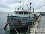
| Platform |
|
||||||||
| Itinerary |
|
||||||||
| Bounds |
|
| Organization |
384 Woods Hole Road
Quissett Campus
Woods Hole, MA02543-1598
(508) 548-8700
|
||||||||||||
|---|---|---|---|---|---|---|---|---|---|---|---|---|---|
| Principal investigators | William C Schwab | ||||||||||||
| Crew members |
|
||||||||||||
| Information specialist(s) |
|
||||||||||||
| Affiliate staff | Shawn Dadisman (Data Processing); Paul Byham (Submetrix, Inc. Field Technician) |
| Data category: | Location-Elevation, Seismics, Sonar |
|---|---|
| Data type: | Navigation, Sub Bottom Profiler, Single Beam, Sidescan, Boomer, Interferometric |
| Equipment | Usage description | Data types | Datasets |
|---|---|---|---|
| SIS1000 Chirp Sonar | Sub Bottom Profiler | 2 | |
| Single channel hydrophone | Air Gun / Water Gun, Boomer, Bubble Gun, Sparker, Sub Bottom Profiler | 2 | |
| GeoPulse uniboom | Boomer | (no data reported) | |
| SEA SWATHplus-M 234 kHz | Interferometric | (no data reported) | |
| Echosounder | Single Beam | 1 | |
| 3.5 kHz | Sub Bottom Profiler | (no data reported) | |
| DGPS | Navigation | 2 | |
| SIS1000 Sidescan sonar | Sidescan | 1 |
| Dataset name | Equipment | Description | Dataset contact |
|---|---|---|---|
| 1999-044-FA Chirp seismic data | SIS1000 Chirp Sonar | Lines 1-121, plus tie lines 1-28. | David S Foster |
| 1999-044-FA-SE-001 | SIS1000 Chirp Sonar | CHIRP Subbottom Seismic Data - SEG-Y data files for Lines 1-121, plus tie lines 1-28. | William W Danforth |
| 1999-044-FA-SE-002 | Single channel hydrophone | Boomer seismic data | David S Foster |
| Boomer seismic data | Single channel hydrophone | Linda P McCarthy | |
| Bathymetry GIS data | Echosounder | Linda P McCarthy | |
| 1999-044-FA-LN-001 | DGPS | Shotpoint Navigation Data (txt files) GPS navigation data. | William W Danforth |
| Nav data | DGPS | Linda P McCarthy | |
| Sidescan mosaic | SIS1000 Sidescan sonar | Linda P McCarthy |