Field Activity 2000-073-FA

Identifier 2000-073-FA
Alternate names IB F-73-00-ST
Purpose Mapping sea floor environments; ground truthing with video/photo.
Location Stellwagen Bank, North America, North Atlantic;
Comments 
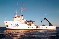
Mobe Monday, Oct. 23 at CG Station in Boston, MA; demobe Saturday AM, Oct. 28 in Boston. Require PLGR navigation system w/ printer; no bridge monitor. All data (video and photo) archived at the SBNMS Headquarters at Scituate, MA. Project = Stellwagen Bank NMS Mapping Project, Stellwagen Bank NMS Mapping Project Information from Foghorn: NOAA video/camera system
Platform
Ferrel
133 feet
Itinerary
Start Boston, MA 2000-10-24
End Boston, MA 2000-10-28
Days in the field 5
Bounds
West -70.283
East -70.183
North 42.2
South 42.183

Personnel

Organization
384 Woods Hole Road
Quissett Campus
Woods Hole, MA02543-1598
(508) 548-8700
Principal investigators Page C Valentine
Crew members
Page C Valentine
Scientist, Staff
Dann S Blackwood
Scientist, Staff
Fuller, Sarah
Scientist, Staff
Middleton, Tammie
Scientist, Staff
Information specialist(s)
Page C Valentine
Specialist, Information
Affiliate principal James Lindholm, NOAA
Affiliate staff James Lindholm, NOAA

Data types and categories

Data category: Imagery, Sampling, Location-Elevation
Data type: Photo, Video, Geology, Navigation

Equipment used

Equipment Usage description Data types Datasets
Camera- deep sea Photo (no data reported)
Video camera - deep sea Video (no data reported)
Digital camera Photo 1
P-code GPS Navigation (no data reported)

Datasets

Datasets produced in this activity

Dataset name Equipment Description Dataset contact
2000-073-FA-PH-001 Digital camera Deck photos of field activity operations Dann S Blackwood

Publications

Samples collected during this field activity